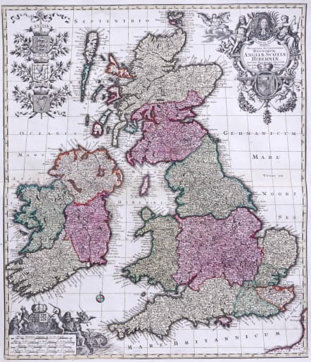
TABULA NOVISSIMA ACCURATISSIMA REGNORUM ANGLIAE, SCOTIAE, HIBERNIAE
Sold
Very attractive map of the British Isles, with 5 large coats of arms, portrait and two large decorative allegorical cartouches. The garlanded cartouche features a portrait of King George I, flanked by classical figures and the arms of the house of Hanover appear below. To the upper left, the shields of England, Scotland and Ireland are shown on a bed of mistletoe.
One of the most decorative maps of the British Isles to appear in an 18th Century Atlas.
Excellent and surprisingly crisp original colour. Cartouche uncoloured as issued.
Very good condition.
REF: Shirley, Seutter 1.
code : M2762
Cartographer : SEUTTER Family
Date : 1730c Augsburg
Size : 60*49 cms
availability : Sold
Price : Sold
Besides the Homanns, the other great German publishers of the eighteenth century were the Seutter family. Mattheus Seutter the elder (1678-1757) was apprenticed to Johann Baptist Homann in 1697 in Nuremberg, but left to settle in Augsburg where he established his own business publishing atlases, including the "Atlas Geographicus" (1725) and "Grosser Atlas" (circa 1735). Seutter's style was heavily influenced by Homann, with distinctive similarities appearing in his maps. He was joined in the business by his son, Albrecht (1722-1762), who continued the firm in partnership with Tobias Conrad Lotter (1717-1777) on his father's death.