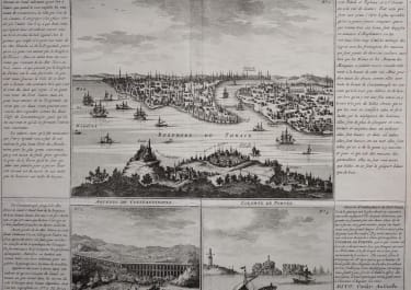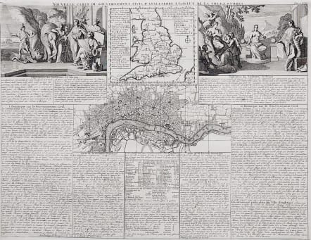
Nouvelle Carte du Gouvernement Civil d'Angleterre et de celuy de la Ville de Londres
Sold
Interesting and attractive map of London.
The Folio sheet contains a map of England and Wales marking the ecclesiastical sees, and the major ports and harbours along the coasts. A plan of London after the rebuilding .. and two engravings with allegorical figures representing the empire. Panels of French text provide a detailed history of the civil governmental structure (civil service, banks, legal, etc.).
Very good condition.
SHIRLEY: British Isles 1650-1750, Chatelain 5; DARLINGTON: 62a
code : M3048
Cartographer : CHATELAIN Family
Date : 1708 Amsterdam
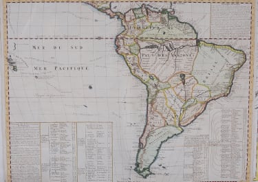
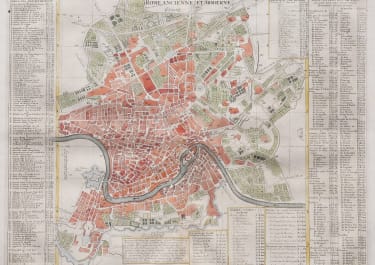
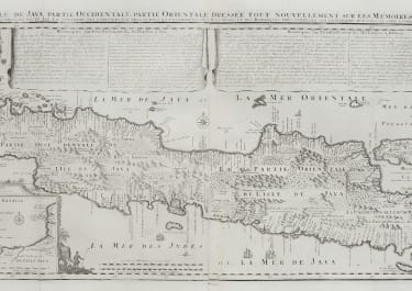
Size : 35*46 cms
availability : Sold
Price : Sold
Zacharie Chatelain (d.1723) was the father of Henri Abraham (1684-1743) and Zacharie Junior (1690-1754). They worked as a partnership publishing the Atlas Historique, Ou Nouvelle Introduction A L’Histoire … under several different Chatelain imprints, depending on the Chatelain family partnerships at the time of publication. The atlas was published in seven volumes between 1705 and 1720, with a second edition appearing in 1732. The maps were accompanied by information pertaining to cosmography, geography, history, chronology, genealogy, topography, heraldry, and costume of the world.