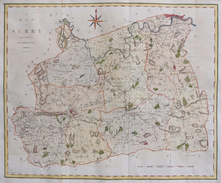
A MAP OF SURRY
Sold
Finely engraved and detailed map of the county by John Cary for the 1789 edition of Camden' s Britannia, the first edition to contain this series of maps.
Compass rose. Excellet hand colour.
Very good condition.
code : M3451
Cartographer : CARY John
Date : 1789 London
Size : 40*49 cms
availability : Sold
Price : Sold
John Cary (1755-1835) was a renowned and active map engraver and publisher, working between 1787 and 1834 in London. Cary’s publications did much to advance the quality and clarity of data presentation on maps. His county maps for Richard Gough’s edition of Camden’s Britannia in 1789 evidenced much improved hachuring (shading to show land relief and physical features) when compared with earlier examples – Cary’s hachuring was much less overbearing than that used by other mapmakers at this time and did not obscure map data.