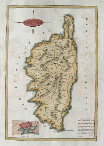
CORSICA
Sold
This beautifully engraved map of the island from Baldwyn's Geography includes on the lower right corner a small block of text describing the island and opposite the text, a small inset plan of the fortress of Bastia. Rare map in very good condition.
code : M2139
Cartographer : CARY John
Date : 1794 London
Size : 24*17cms
availability : Sold
Price : Sold
John Cary (1755-1835) was a renowned and active map engraver and publisher, working between 1787 and 1834 in London. Cary’s publications did much to advance the quality and clarity of data presentation on maps. His county maps for Richard Gough’s edition of Camden’s Britannia in 1789 evidenced much improved hachuring (shading to show land relief and physical features) when compared with earlier examples – Cary’s hachuring was much less overbearing than that used by other mapmakers at this time and did not obscure map data.