
SPANISH NORTH AMERICA
Sold
Classic, attractive and significant map depicting the Spanish possessions in the southwestern part of North America in the early 19th century including what is now the southwest United States from much of Mississippi west to California and importantly the boundaries around the Santa Fe area, and south from New Mexico & Colorado near Pike's Peak to Yucatan thereby including a good portion of Mexico including Baja. The progenitor of this important map, according to Wheat, was primarily the epic Humboldt and Pike maps, and to some extent also the Pinkerton and Arrowsmith maps of North America and the American Southwest published just a few years earlier.Expertly laid down but the map is in pristine condition. SOLDcode : M518
Cartographer : John Thomson
Date : 1814 London
Size : 51*64cms
availability : Sold
Price : Sold
THOMSON, John
flourised 1814-1869
John Thomson produced two major works in his life time, A New General atlas of the World 1814-28 and Atlas of Scotland 1820-32. The maps from A New General atlas of the World were printed in full hand coloring from large copperplate engravings. The level of detail at the time of publication was heralded as a breakthrough in British cartography and Thomson rightly earned a great deal of attention and his work copied for a number of years

£150
Russia

Russia

Pacific & Australasia

South America
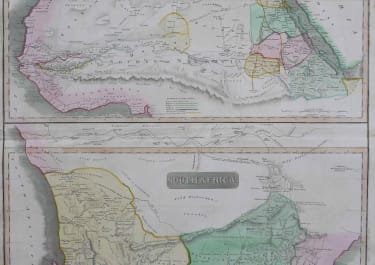
Africa

Polar

£95
Central America

£150
British Isles

North America
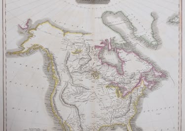
North America
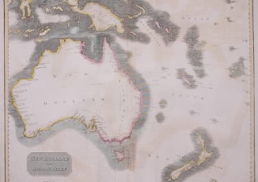
Pacific & Australasia