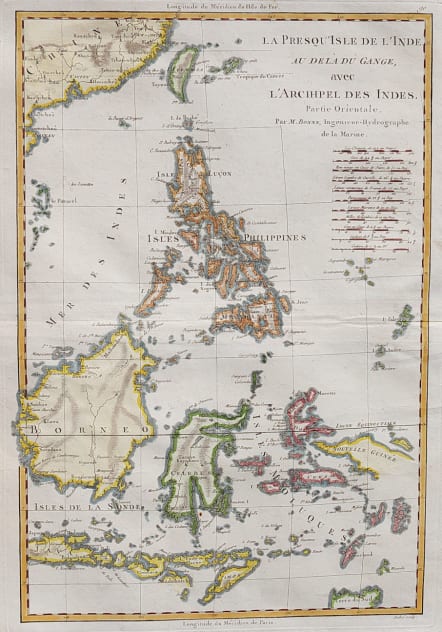
LA PRESQU'ISLE DE L'INDE AU DELA DU GANGE AVEC L'ARCHIPEL DES INDES PARTIE ORIENTALE
Sold
Attractive and detailed map of the East Indies is focused on the islands of Java, Borneo, the Philippines, Celebes, and the lesser islands of the archipelago. The northern tip of Australia is shown at lower right (Terre du Sud) and the coast of China with Formosa is at top. Eleven different mileage scales are noted below the title. Engraved by Andre.
Good hand colour
Very good condition
code : M4068
Cartographer : BONNE Rigobert
Date : 1780 Paris
Size : 24*39.5 cms
availability : Sold
Price : Sold
Rigobert Bonne (1727-1795), a prolific French cartographer, was active between about 1760 and 1788, working in the French Hydrographical Office, and appointed as Hydrographer to the French King.
Bonne prepared a large number of charts, some of which appeared in the Atlas Maritime. Today, he is best known for the smaller maps that he prepared for Raynal’s Atlas de Toutes Les Parties Connues du Globe Terrestre, published in 1780, and the Atlas Encyclopedique, published in conjunction with Nicholas Desmarest. Although the maps are relatively plain, dispensing with the decorative embellishment of mid-century, they are detailed and provide good coverage of newly discovered regions.