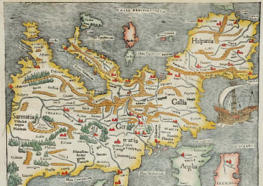
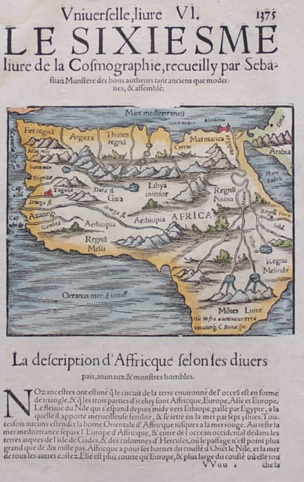
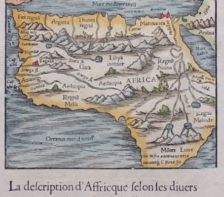
LA DESCRIPTION D'AFFRICQUE
Sold
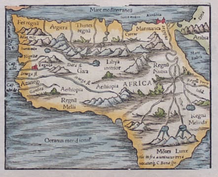
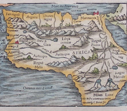
This map of Africa is in the book of Munster's Cosmography that begins the description of Africa. The map depicts the major features of Africa. Interestingly, unlike Munster's double page map of Africa, this map labels the Mountains of the Moon (Motes Lunae), the supposed source of the Nile River. This map was first issued in Sebastian Munster's Cosmographia. The map was unchanged from 1544 . This particular map comes from a French edition of Munster's Cosmographia..
Superb hand colour.
Very good condition.
code : M3830
Cartographer : Sebastian Munster
Date : 1570c Basel
Size : 31*20 cms page size
availability : Sold
Price : Sold
Originally a scholar studying Hebrew, Greek and mathematics, Sebastian Munster (1489-1552) eventually specialised in mathematical geography and cartography. It was this double ability - as a classicist and mathematician - that was to prove invaluable when Munster set himself to preparing new editions of Solinus’ “Memorabilia” and Mela’s “De Situ Orbis”, two classical descriptive geographies containing maps, and his own two greatest works, the “Geographia” and “Cosmographia”. These reflect the widespread interest in classical texts, which were being rediscovered in the fifteenth century, and being disseminated in the later fifteenth and sixteenth century, through the new medium of printing.
The “Geographia” was a translation of Ptolemy’s landmark geographical text, compiled in about 150 AD., illustrated with maps based on Ptolemy’s calculations, but also, in recognition of the increased geographical awareness, contains a section of modern maps. In the first edition of the “Geographia”, Munster included 27 ancient Ptolemaic maps and 21 modern maps, printed from woodblocks. Subsequent editions of the “Cosmographia” were to contain a vast number of maps and plans.
One consequence of Munster’s work was the impetus it gave to regional mapping of Germany, but Munster was also the first cartographer to produce a set of maps of the four continents on separate maps. Most importantly, through his books (the “Geographia” and “Cosmographia” alone ran to over forty editions in six languages), Munster was responsible for diffusing the most up-to-date geographical information throughout Europe.