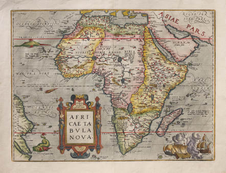
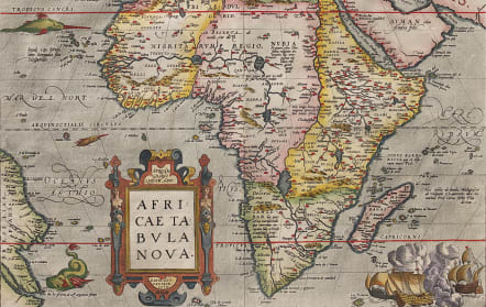
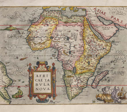
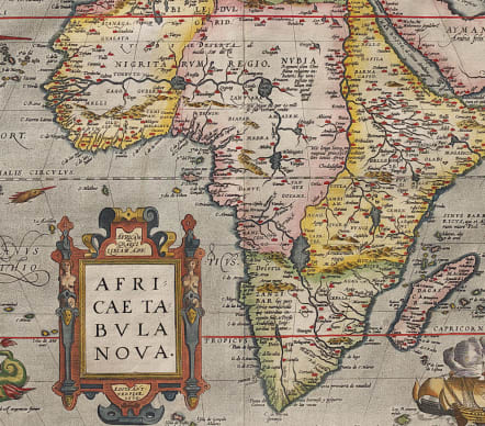
AFRICAE TABULA NOVA
£1495
Superb full colou map is the cornerstone maps of Africa and remained the standard map of Africa well into the seventeenth century. Dated 1570 on map but 1585.
It was designed by Ortelius from elements of contemporary maps by Gastaldi, Mercator, and Forlani and used several recent sources: Ramusio in Navigationi et Viaggi (1550), Joao de Barros in Decadas da Asia (1552), and Leo Africanus in Historiale description de l'Afrique (1556). The majority of the nomenclature is taken from Gastaldi. The Nile is based on the Ptolemaic concept, originating from two large lakes south of the equator. Curiously Ortelius did not represent the Mountains of the Moon (a prominent feature on most prior maps) and the twin lakes are not named. Ortelius introduced two important changes to the shape of the continent on this map; the Cape of Good Hope is more pointed, and the eastward extension of the continent was reduced significantly. The map is decorated with a strapwork title cartouche, a grand sea battle (copied from Diego Gutierez' wall map of the Americas), and sea monsters. This beautiful map was engraved by Frans Hogenberg who engraved many of the maps for the Theatrum.
Excellent hand colour
Near mint with no repairs etc Large blemish free margins...Recommended**
References: Betz #12.6; Van de Broecke #8; Norwich #10 :Tooley (AF) p. 88.
code : M4139
Cartographer : Ortelius Abraham
Date : 1595 Antwerp
Size : 37* 50.5 cms
availability : Available
Price : £1495
From about 1560, possibly as a result of his friendship with Mercator, Ortelius began to produce maps - an eight sheet world map being the earliest. At this time, Ortelius also began preparing his greatest project, the Theatrum Orbis Terrarum. Having already become probably the greatest cartographic bibliographer of the period, Ortelius was able to prepare 53 map sheets based on the most up-to-date information, which were engraved by Frans Hogenberg, and first published in 1570.
The atlas achieved instant fame as "the world's first regularly produced atlas" (Skelton), being the first atlas with maps prepared to a uniform format. It was also an immediate commercial success, being reprinted four times in 1570. . Over 30 different editions, with text in Latin, French, Dutch, German, Italian, English or Spanish, testify to the popularity and esteem attributed to the work. Marcel Van Den Broecke, whose fascinating work on Ortelius and his maps is often quoted, estimates that around 7300 complete atlases were published using a total of 234 copperplates, either replacements or reworkings as plates became out-dated, worn, or as new information became available. Amongst this latter category, the maps added in the 1580's and 90's of the world, the Americas, China, the Pacific, Japan, Peru and Florida, and Iceland are important historically and justly famous.The maps themselves are finely engraved, often very decorative and generally found with text on the reverse.
After Ortelius' death in 1598 the atlas continued to be printed and published by the Plantin Press. Between 1602 and 1609 it was published by Johann Baptist Vrients, who added a variety of fine maps including the very decorative large plates of England and Wales, and of Ireland. Publication reverted to the Plantin Press, under the control of the Moretus brothers, from 1612.
Although only the relatively unsuccessful atlases of De Jode and, ultimately, Mercator were published during the sixteenth century life of the Theatrum …, in 1607 Jodocus Hondius's issue of Mercator's Atlas ... with many newly prepared maps began to supersede Ortelius' work.
Ortelius's small Atlas The Epitome published from 1590 ran for many editions and was very popular.