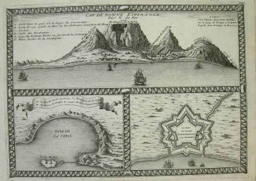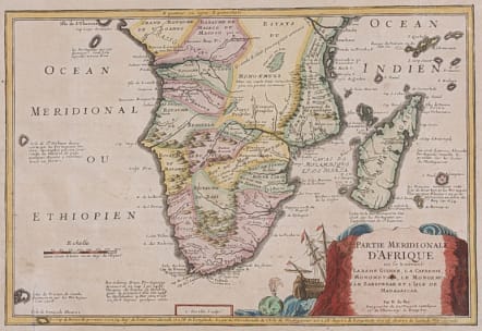
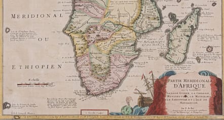
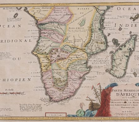
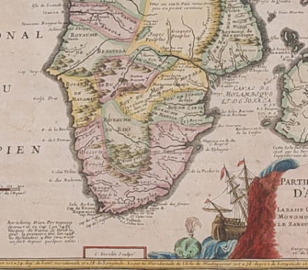
PARTIE MERIDIONALE D'AFRIQUE OU SE TROUVENT LA BASSE GUINEE....
£295
Full Title Partie méridionale d'Afrique où se trouvent la Basse Guinée, la Cafrerie, le Monomotapa, le Monoemugi, le Zanguebar et l'isle de Madagascar..
Striking map of Southern Africa the 'Zaire' river south.
Detailed for the period with many place names.. All the Kingdoms marked.
There is a small legend at the lower border describing the discovery of the Cape by Bartholomew Diaz in 1486 and the construction of a Dutch fort.
Cartouche with Galleon & whale
Small closed tear barely visible.
Very good hand colour
Very good condition
Norwich, Maps of Africa, map 167.
Publication ..Atlas Curieux.
code : M4312
Cartographer : DE FER Nicolas
Date : 1705 Paris
Size : 21.5*32 cms
availability : Available
Price : £295
Nicolas de Fer (1646-1720) was the son of Antoine de Fer, also a map engraver and colourist in his own right who had worked with Nicolas Berey and acted as an editor for Pierre Duval's "Cartes De Geographie ..." of 1657. However, it was Nicolas who was to become one of the most prolific publishers of his time.
De Fer was able to make the publishing business flourish and in 1690 he was nominated as geographer to the Dauphin - their relationship had reciprocal benefits with De Fer producing, in effect, royal propaganda concerning the Dauphin's lands with each publication enhancing his own name and reputation, as well as that of the Dauphin. When the Duke of Anjou ascended the throne in 1702, De Fer had the dual title of "geographe du roi d'Espagne et du Dauphin".
De Fer published a number of atlases including the "Cotes de France" of 1690 (containing Tassin's maps) and the "Forces de l'Europe ou Introduction a la fortification", also of 1690, that reinforced his abilities and success with the buying public. Subsequent publications included the "Petit et Nouveau Atlas", which appeared in 1697, followed by the "Atlas Curieux". The "Atlas Curieux" was well-known and popular, being expanded in successive editions between 1700 and 1705, and was re-edited in 1714 and 1716 under the title "Suite de l'Atlas Curieux". De Fer also produced a number of folio maps that appeared in the "Atlas ou Recueil de cartes", which was published in 1709.