CEYLON
Sold
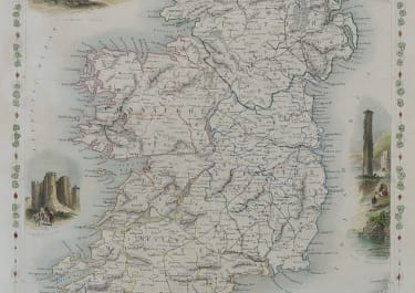
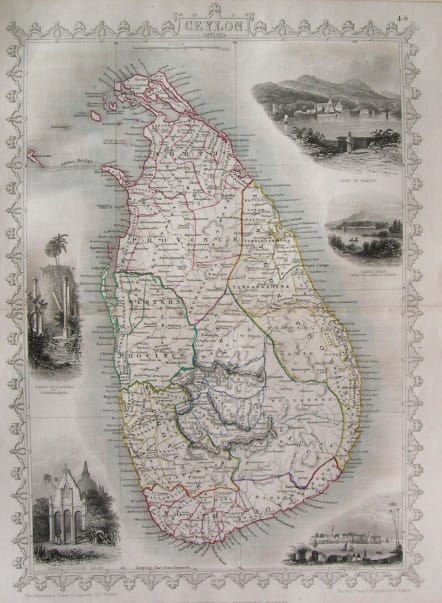
Striking example of the John Tallis map of Ceylon.
Decorative Vignettes Lake of Kandy, Adams Peak from the Lake of Colorado, Temple of Buddha Kalany and the Ruins of the Dagora at Toopharamaya Engraved for R. Montgomery Martin's Illustrated Atlas. Tallis was one of the last great decorative map makers. His maps are prized for the wonderful vignettes of indigenous scenes, people, etc.
Very good condiotion.
code : M2406
Cartographer : Tallis John
Date : 1851 London
Size : 33.5*24cms
availability : Sold
Price : Sold
TALLIS, John
active 1838-1851
John Tallis founder of Tallis and Co., London map publishers who traded under various names: L. Tallis, Tallis & co, John Tallis, John Tallis & co. (London & New York) between 1838 and 1851. After 1850-51, their maps were published by the London Printing and Publishing Co., London and New York.
The Illustrated Atlas of the World, published in 1849 with the maps and decorative vignette's engraved and drawn by J. Rapkin, was one of the last atlases to be truly decorated and is therefore highly prized.