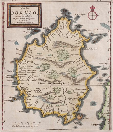
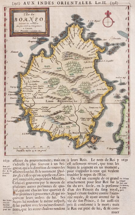
L'ILE DE BORNEO
Sold
Good early and detailed map of Borneo originally published for Galerie Agreeable du Monde ; here for the Travel book published in 1719 with complementary text.
Attractive with riversand forests and many place names.
Excellent hand colour
Very good condition
'l'Ile de Borneo, suivant les memoires des plus celebres navidateurs.' (The island of Borneo, according to the most celebrated navigators.)
References: Van der Krogt A, 55:07; Durant-Curtis, #36.
From: J.A. von Mandelslo, Voyages celebres & remarquables, faits de Perse aux Indes Orientales. Leiden, P. van der Aa, 1719.
code : M4777
Cartographer : Pieter Van Der AA
Date : 1713/1719
Size : 19.5*17 cms sheet 33*20 cms
availability : Sold
Price : Sold
Pieter Van Der Aa (1659-1733)
Van Der Aa was a prolific publisher, working in Leiden during the first three decades of the eighteenth century. Much of his output consisted of re-issues and re-engravings of map and view plates that he had acquired from earlier mapmakers. Little of his output was original, though that which is has a very distinct style, precisely and elegantly engraved, and is much sought-after today.
Perhaps his most remarkable publication was the elaborate Galerie Agreable Du Monde, issued in 1729, in 66 parts, bound into 27 volumes, which contained about 3,000 plates, apparently limited to 100 sets. Another of his extensive publications was the Cartes Des Itineraires Et Voyages Modernes, a collection of 28 volumes of travel accounts, illustrated with a series of small, but finely engraved maps, often with decorative pictorial title-pieces.
An interesting feature of Van Der Aa's method is that several of his atlases include maps printed within large, separately engraved, elaborately designed mock-frame borders, which were prepared with a blank centre so that individual maps could be over-printed on that area.
Despite the quantity and variety of Van Der Aa's publications they seem to have had only a limited circulation, and so are now scarce.