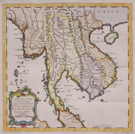
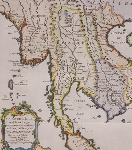
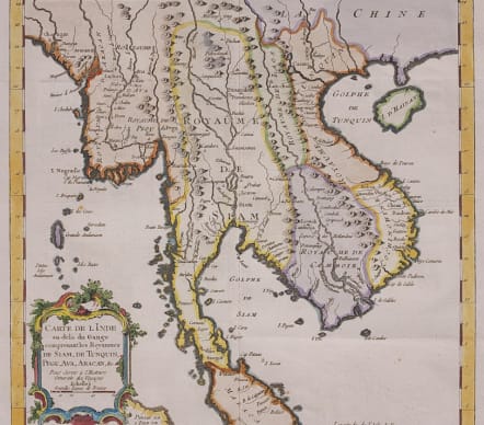
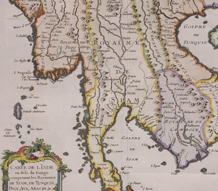
CARTE DE L'INDE AU DELA DU GANGE COMPRENANT LES ROYAUMES DE SIAM, DE TUNQUIN, PEGU AVA, ARACAN
Sold
Attractive and detailed map covers Thailand, Vietnam, Malaysia, Cambodia, and Burma, with a small portion of China and Sumatra. The river systems are boldly engraved, including the Mekong Delta, and the topography is depicted pictorially. Adorned with a rococo cartouche.
Excellent hand colour
Very good condition
Publication: La Harpe's Histoire Generale des Voyages
code : M4341
Cartographer : Jacques-Nicolas BELLIN
Date : 1780
Size : 28*28 cms
availability : Sold
Price : Sold
Jacques-Nicolas Bellin (1703-1772) was one of the most important and prolific French cartographers of the mid-eighteenth century, in the service of the French Hydrographical Office. He was appointed the first Ingenieur Hydrographe de la Marine, and also Official Hydrographer to the French King.
Bellin was responsible for an enormous output of charts and maps. In a large folio format, he issued a volume of sea-charts of France, the Neptune Francois, and several sea-atlases of the World, including the Atlas Maritime and the Hydrographie Francaise. These large charts were amongst the best of the period and continued being reissued throughout the second half of the eighteenth century.
In smaller format, he issued the Petit Atlas Maritime (1764),which contained 580 detailed charts, as well as maps to illustrate l'Abbe Prevost's Histoire Generale des Voyages (1746-1757). Bellin also produced a substantial number of important separately issued maps, particularly reflecting continuing discoveries and political events in the Americas.


