
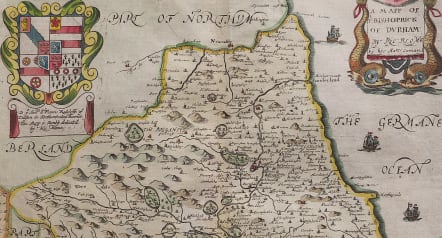
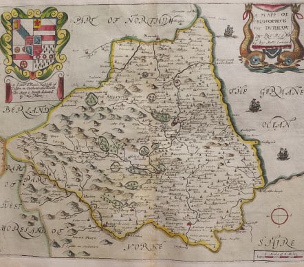
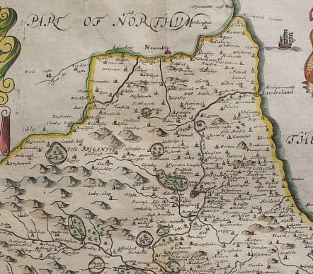
A MAPP OF YE BISHOPRICK OF DURHAM BY RIC BLOME
£195
Attractive, detailed copper engraved map of Durham from Richard Blome.
From the First Edition of the "Britannia", Blome's larger series of county maps, decorated with cartouches around the title and dedication, based on Speed's map. Blome, renowned as a plagarist, said "I do not own myself the Author, but the Undertaker of this work".
I like the Blome maps for intricate engraving and cartouches. Rarer than the Morden maps.
Excellent hand colour
Very good condition
code : M4765
Cartographer : Richard Blome
Date : 1673 London
Size : 27*33 cms
availability : Available
Price : £195
Richard Blome (1641-1705) was an English publisher and bookseller who flourished from about 1670 to 1705. He published two series of English county maps. The large series appeared in Blome's Britannia, or a Geographical Description of the Kingdomes of England, Scotland and Ireland, with each map measuring approximately 300 x 250mm. The smaller series, with the maps approximately 240 x 180mm, were published in Blome's Speed's Maps Epitomiz'd: or the Maps of the Counties of England.
Blome also issued a world atlas, the Geographical Description of the Four Parts of the World, in 1670, which was re-issued as the Cosmography and Geography, in 1682 and 1693. The maps from this atlas were Anglicized copies of Nicolas Sanson's work. Blome also issued a number of Bible maps, usually after Visscher.


