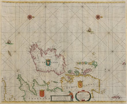
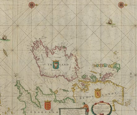
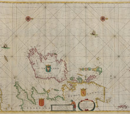
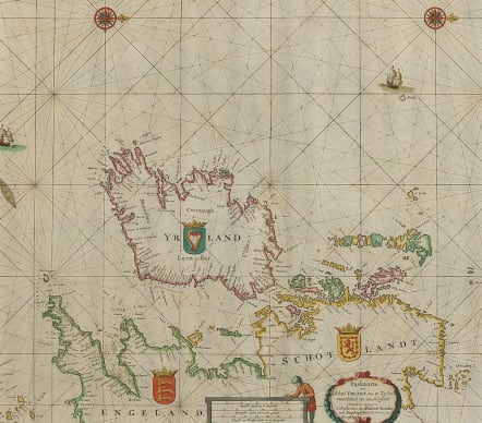
PASKAARTE OM ACHTER YRLANT OM TE ZEYLEN
£495
Very attractive sea chart of Ireland and the British Isles from Cornwall to Scotland.
Early state of Donckers chart of the Ireland and Scotland.
This is a striking sea chart, showing north oriented to the right and embellished by decorative cartouches, sailing ships coats of arms and two decorative compass roses. The map identifies soundings, sand bars, fishing banks and navigational hazards.
Some minor reinforcement on rear centre fold invisible.
Excellent hand colour
Very good condition for this stunning sea chart
References: Koeman, Don8B [7].
From: De Zee-Atlas of Water-Waerelt, Vertoonende alle de Zee-Kusten Van het bekende des Aerd-Bodems Met een generale beschrijvinge der selve:Seer dienstigh voor Schippers en Stuur-lieden, mitsgaders Kooplieden om op 't Kantoor gebruckt te worden. ... t' Amsterdam, By Hendrick Doncker, 1665. (Koeman, Don5A)
code : M4883
Cartographer : DONCKER Hendrik Doncker
Date : 1665 Amsterdam
Size : 43.5*53 cmd
availability : Available
Price : £495
Hendrick Doncker (1625-1699)
Hendrick Doncker became a member of the bookseller's guild in 1647 and ran his shop successfully for fifty years. He was able to develop one of the most popular sets of maritime works published in Amsterdam during the Golden Age.
In 1651 he bought a house in the Nieuwe Brugsteeg in Amsterdam. It was called 'in 't Stuurmans gereetschap' (in the mariners' instruments) and stood opposite the house where Johannes van Keulen later settled.
Doncker's charts were the most up-to-date in the second half of the 17th century. Although there is some similarity to those charts published by Van Loon, Goos, Lootsman, and Doncker, the latter's charts are original.
In 1655, Hendrick Doncker had begun with the publication of a pilot guide, the Lichtende Columne ofte Zeespiegel. In 1659 he published his first sea atlas, the Zee-Atlas of Waeter-waereld, with 19 maps. Between 1659 and 1669, he increased the number of charts from 19 to 30 and in 1669 he came with an edition containing 50, which was soon to be followed by an edition with large maps: the Nieuwe Groote Vermeerderde Zeeatlas, also with 50 charts.
