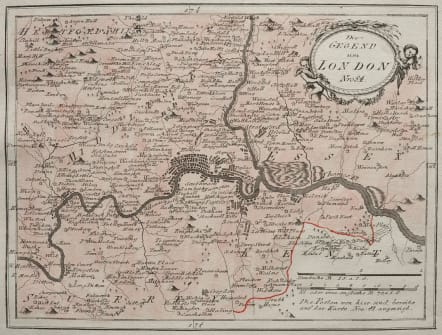
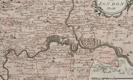
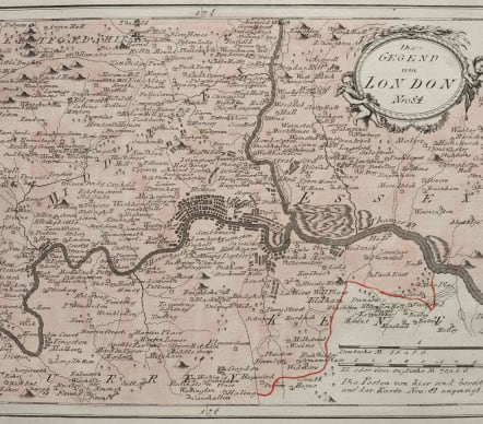
LONDON DIE GEGEND UM LONDON
Sold
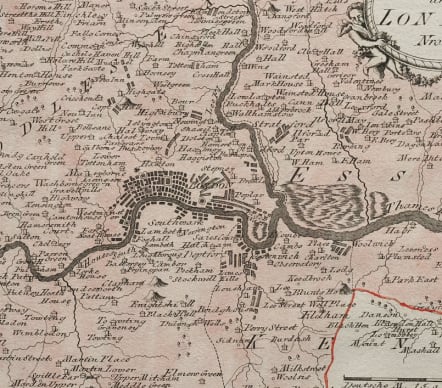
Attractive and detailed map of London by Franz Johann Joseph von REILLY from Schauplatz der funf Theile der Welt,printed Vienna 1789.
Light original wash colour and some outline colour.
Detailed showing London at the end of the 18thC.
Covers the area from Enfield,Croydon,Hampton and Hornchurch which were all villages.
An interesting and scarce map in mint condition.
code : M4910
Cartographer : REILLY VON Franz Johann Joseph
Date : 1789 Vienna
Size : 21*28 cms
availability : Sold
Price : Sold
Austrian born Franz Johann Joseph von Reilly (1766-1820) produced over 830 maps for his great atlas project, "Schauplatz der funf Theile der Welt" between the years 1789 and 1806. Of these 830 maps published over this time span of seventeen years, he 'showcased' but one part of the world, Europe. Maps of the other four continents remained unpublished. The maps of the "Schauplatz ..."were drawn to a uniform criteria.
Reilly's "Grosser deutscher Atlas" was also notable as the first completely 'Austrian' atlas. This large world atlas, containing relatively few maps, was issued between 1794 and the end of 1796. Reilly may have used Franz Anton Schraembl's work as his model, at least in part.