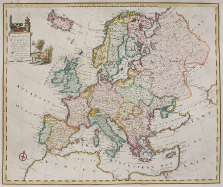
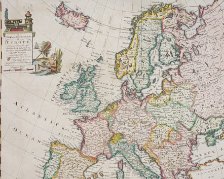
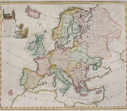
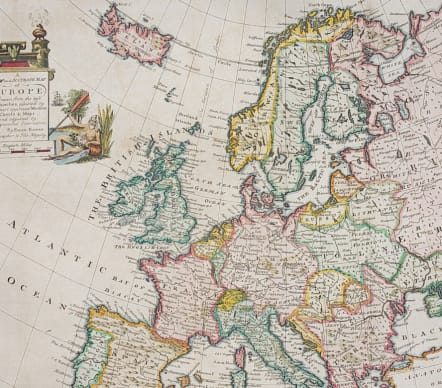
A NEW AND ACCURATE MAP OF EUROPE ..
Sold
Title : A New and Accurate Map of Europe Drawn From the best Authorities and assisted by the most approved Modern Charts & Maps..
Attractive map of Europe by Emanuel Bowren.
Includes Iceland and extends east to where the Volga River discharges into the Caspian Sea. The map is filled with political boundaries, cities, rivers, and a few topographical details.
Decorative Cartouche
excellent hand colour
Very good condition
Publication : John Harris' Complete Collection of Voyages and Travels. London, 1748
code : M4331
Cartographer : Emanuel BOWEN
Date : 1744 London
Size : 37.5*45.5 cms
availability : Sold
Price : Sold
Emanuel Bowen (c.1693/1694-1767) was an English engraver, publisher and mapseller active in London between 1720 and 1767. His prolific output as engraver and publisher earned him recognition both in England and France, for he held the dual appointment of Engraver to George II and to Louis XV of France.
Bowen engraved large numbers of maps for general atlases, geographical text-books and periodicals, particularly The Complete System of Geography, the Universal History of the World, the small-format periodical The General Magazine of Arts and Sciences and the Complete Atlas.
Bowen also produced a large number of English county maps. His earliest known publication was a series of road maps of England and Wales, the Britannia Depicta, with a map of each county, produced in partnership with John Owen in 1720 (the Owen and Bowen maps). This series was very popular, being frequently re-issued up to 1764 and was the most successful successor to John Ogilby's renowned road book.