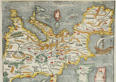
CYPRUS INSULA
Sold
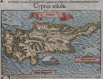
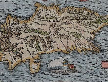
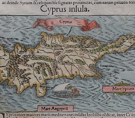
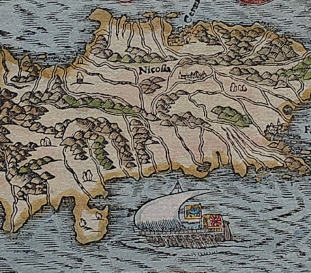
Vignette woodcut map of Cyprus from Sebastian Münster's famous "Cosmographia". set in a page of text; Latin text and further vignette to verso.
The map which first appeared in the 1542 Latin edition, shows the island with a banner title and ship to sea. Set in a page of text about the island on the verso of the map is a woodcut vignette depicting 2 deer as the text quotes Pliny " Stags cross the sea in herds, swimming in a long line, the head of each resting on the haunches of the one that precedes it, each in its turn falling back to the rear. This has been particularly remarked when they pass over from Cilicia to the island of Cyprus. Though they do not see the land, they still are able to direct themselves by the smell. "Pliny the Elder: Natural History Book 8 ch 32.
Galleon, etc
Excellent hand colour in mint condition.
ZACHARAKIS: 1586, illus pl. 328.
code : M3517
Cartographer : Sebastian Munster
Date : 1544 Basel
Size : 10*15 cms excluding text sheet with text 28*20cms
availability : Sold
Price : Sold
Originally a scholar studying Hebrew, Greek and mathematics, Sebastian Munster (1489-1552) eventually specialised in mathematical geography and cartography. It was this double ability - as a classicist and mathematician - that was to prove invaluable when Munster set himself to preparing new editions of Solinus’ “Memorabilia” and Mela’s “De Situ Orbis”, two classical descriptive geographies containing maps, and his own two greatest works, the “Geographia” and “Cosmographia”. These reflect the widespread interest in classical texts, which were being rediscovered in the fifteenth century, and being disseminated in the later fifteenth and sixteenth century, through the new medium of printing.
The “Geographia” was a translation of Ptolemy’s landmark geographical text, compiled in about 150 AD., illustrated with maps based on Ptolemy’s calculations, but also, in recognition of the increased geographical awareness, contains a section of modern maps. In the first edition of the “Geographia”, Munster included 27 ancient Ptolemaic maps and 21 modern maps, printed from woodblocks. Subsequent editions of the “Cosmographia” were to contain a vast number of maps and plans.
One consequence of Munster’s work was the impetus it gave to regional mapping of Germany, but Munster was also the first cartographer to produce a set of maps of the four continents on separate maps. Most importantly, through his books (the “Geographia” and “Cosmographia” alone ran to over forty editions in six languages), Munster was responsible for diffusing the most up-to-date geographical information throughout Europe.