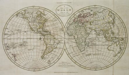
WORLD A MAP OF THE WORLD FROM THE BEST AUTHORITIES
Sold
The 1785 larger world map.
Detailed map of the World, showing tracks of Captain James Cook in his 3 voyages in great detail. The map is extensively annotated with information on the explorations of a number of regions on the map in the 1770s, primarily deriving from Cook. New Zealand is shown. Australia retains it’s a mostly conjectural mid-18th Century Coastline. No sign of Antarctica. Fascinating transitional mapping of Alaska and NW America.
Reinforcement of fold otherwise good condition.
SOLD
code : M2447
Cartographer : GUTHRIE William
Date : 1785 London
Size : 36*55cms
availability : Sold
Price : Sold
Atlas Universel pour la Geographie de Guthrie reengraved by Blondeau


Eastern & Central Europe

Low Countries

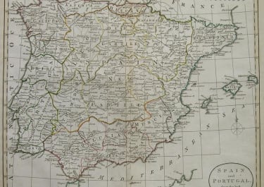
Spain & Portugal

Scandinavia

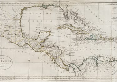
West Indies