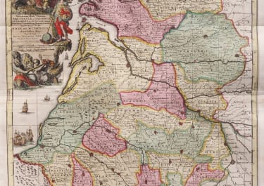
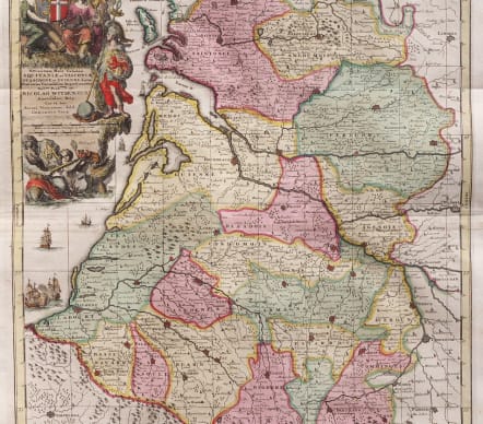
NOVISSIMAM HANE TABULUM AQUITANIAE ET VASCONIAR NICOLAO WITSEN GERADUS VALK
£395
Novissimam Hanc Tabulam Aquitaniæ et Vasconiæ, Guascogniæ et Guienne dictae Provincias Curiosissime Representationem Nob.mo Prud.mo D°. Nicolao Witsen
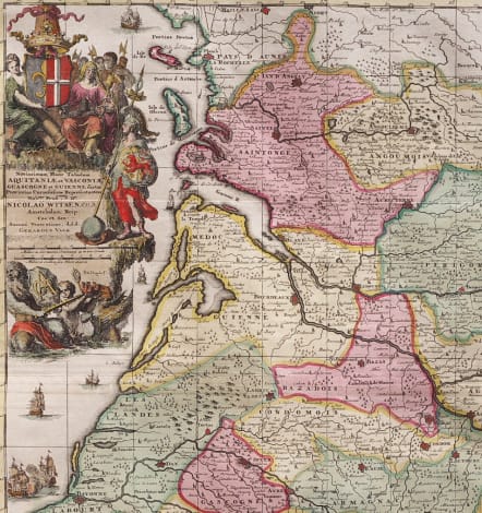
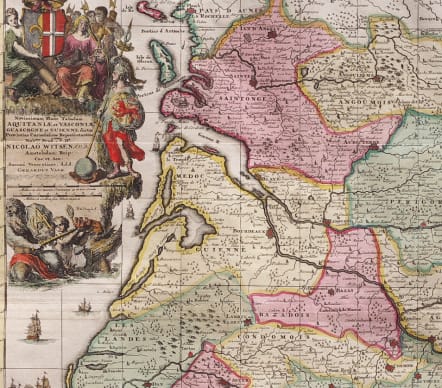
Striking and beautiful original colour example of this scarce map of Southwestern France, engraved by Romain De Hooghe for Gerard Valk. The map extends from the Isle de Re and La Rochelle in the north to Conserans, Bigorre, Bearn, Soule and Basse Navare in the south, centered on Bordeaux and the course of the Garonne River. Includes a superb allegorical cartouche which includes a coat of arms, elaborate military and state scene, a primary warrior with a second coat of arms engraved into his shield and a second allegorical scene depicting the region's naval and sea faring tradition. The cartouche is signed by De Hooghe, whose work is among the most prized of all map engravers of the late 17th Century.
Excellent original colour
Near Mint condition
code : M5113
Cartographer : SCHENK & VALCK
Date : 1695 Amsterdam
Size : 56.5*47.5 cms
availability : Available
Price : £395
The Schenk family, with co-publishers, the Valks, were among the most prolific and best known publishers of eighteenth century Amsterdam, issuing prints, maps, books and atlases. Their work was invariably finely presented though was primarily reissued from other map-makers’ printing plates, including Visscher, De Wit, Jansson and others. However, their work demonstrates the precision and elegance associated with maps and engravings produced in this important cartographical period.