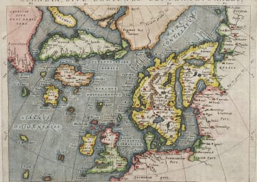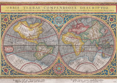
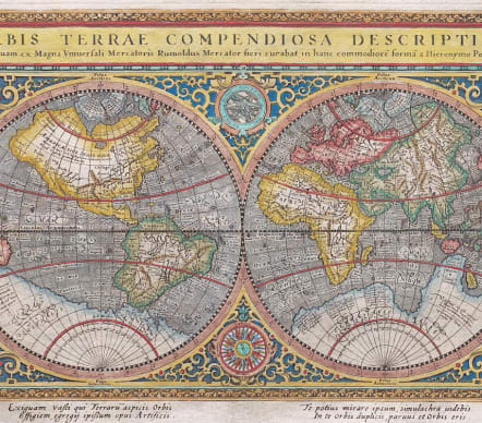
ORBIS TERRAE COMPENDIOSA DESCRIPTIO
£895
Superb reduced version of Mercator's famous 1569 World map. Engraved by Porro The title mentions Romuldus Mercator .
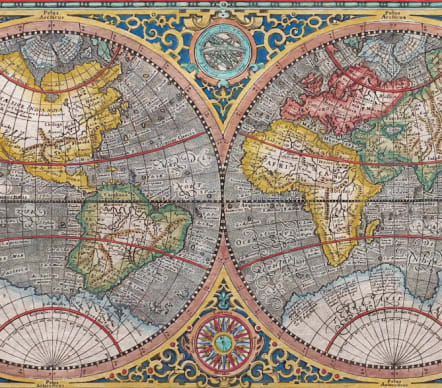
Gerard Mercator's world map was condensed into double-hemisphere form by his son Rumold, preserving the bulge to the coast of South America. The hemispheres are surrounded by an elaborate strapwork border; between them lie an armillary sphere and compass-rose.
Girolamo Porro was able to preserve an incredible amount of the original detail n his reduction, including text on the Southern Continent
The map includes a classical late 16th Century configuration of the World, including a Northwest Passage, unusual depiction of the North Pole, massive Terrae Australis, narrow passage between South America and Terrae Australis, bulging western portion of South America and unusual treatment of North America, to name but a few of its features. Some of the placenames mentioned by Marco Polo in Asia are present, as are several of the mythical islands of the Atlantic.
Finely engraved Excellent hand colour
Very good condition
REF : Shirley 194.
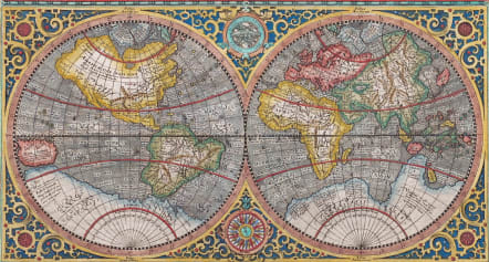
From: Geographicae Universae tum veteris novae . . . Auctore Io. Ant. Magino. Cologne, P. Keschedt, 1598 - Pirate edition after Magini's original work of 1596.
code : M5593
Cartographer : MAGINI Giovanni
Date : 1598
Size : 17*25 cms sheet 21.5*27 cms
availability : Available
Price : £895
Giovanni Antonio Magini (1555-1617) was born in Padua, Italy, and studied medicine, mathematics, astronomy and philosophy at the University of Bologna where he was later to become a professor of astronomy. He corresponded with many of the renowned figures of the age including Ortelius, Tycho Brahe, Galileo and Johanes Kepler. He authored various works on astronomy and also produced the first printed atlas of Italy, which was published posthumously by his son Fabio. Other works included the "Geographiae Universiae" (1597) and "Moderne Tavole Di Geografia" amongst others.