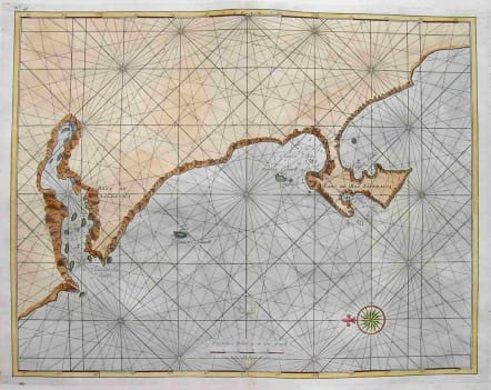
SEA CHART CAPE TOWN
Sold
RARE! Sea chart around Capetown.Dutch.Shows anchorages.Compass rose and rhum lines.Full hand colour.Repaired worm holes otherwise very good condition for this interesting map. REF only reference is Stanford University Library It sdays map printed London!!code : M1978
Cartographer : NIEUHOF Johannes
Date : 90/ 1703
Size : 30*39cms
availability : Sold
Price : Sold
Nieuhof, Johannes, 1618-1672
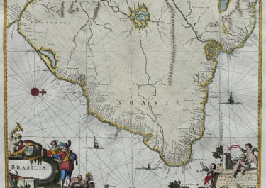
South America