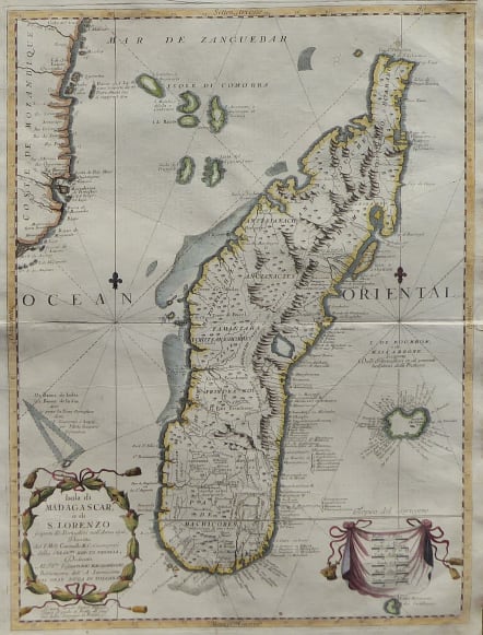
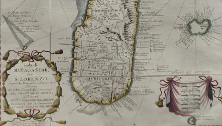
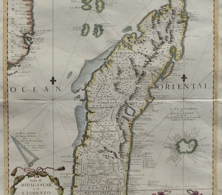
ISOLA DI MADAGASCAR O DI S. LORENZO
Sold
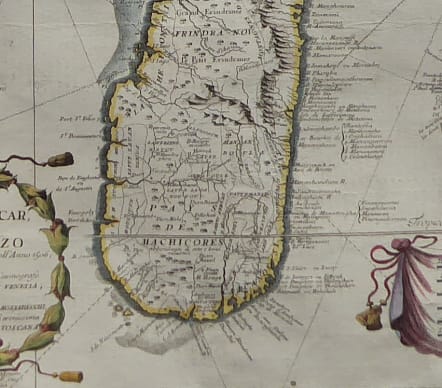
A beautiful and detailed engraved large-scale map of Madagascar, formerly named San Lorenzo by the discoverers, the Portuguese. Shows also in detail the Comorra Islands Group and, very nice an detailed the Ile de Bourbon, better known as Ile de Reunion". Also showing the nearest coast line of Mozambique..
The map is by the late 17th century Venetian cartographer, Vincenzo Coronelli.
A decorative title cartouche appears bottom left in the form of a banner supported by playful winged mermaids and cherubs.
Excellent hand colour
Very good condition
code : M4166
Cartographer : CORONELLI Vincenzo Maria
Date : 1698 Venice
Size : 60*45 cms
availability : Sold
Price : Sold
Vincenzo Maria Coronelli (1650-1718) is widely recognised as one of Italy's most famous and greatest cartographers
Coronelli constructed two globes for the Duke of Parma and their success insured an invitation to Paris where he was to construct another, very large-scale (some fifteen feet in diameter) pair of globes for Louis XIV
In 1680 Coronelli also founded the oldest surviving geographical society - the Academia Cosmografica degli Argonauti.
As 'Map-maker Royal' to Louis XIV, Coronelli was based in Paris from 1681 to 1683. Here he had access to the latest French manuscript records, which he incorporated into his printed maps. Coronelli also published numbers of important maps in conjunction with the French publisher, Jean Baptiste Nolin. Nolin had engraved a set of celestial globe gores for Coronelli in 1688 and went on to become the French publisher of Coronelli's maps
Coronelli also published the Atlante Veneto (1691-1696), which was intended as a continuation of the Blaeu Atlas Maior. This vast work comprised some thirteen volumes and a wealth of information. Lists were included of ancient and modern geographers along with astronomical, geographical, historical and ecclesiastical detail. The maps from the Atlante Veneto are engraved in characteristic fine bold style, using the latest geographical information available. Many of the more important maps were engraved on two sheets, to allow greater detail.