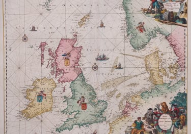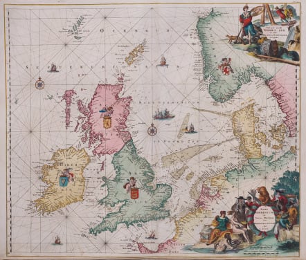
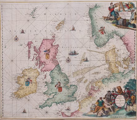
PASCAERT VANDE NOORT-ZEE MARE GERMANICUM RENARD
£2000
Stunningly beautiful example of Louis Renard's sea chart of the North Sea, first issued by Frederick De Wit in 1675. This is second state with names of Seas added .
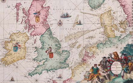
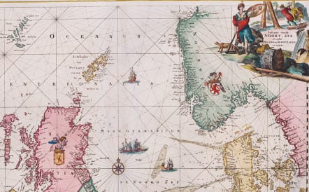
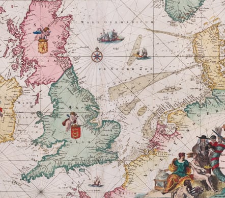
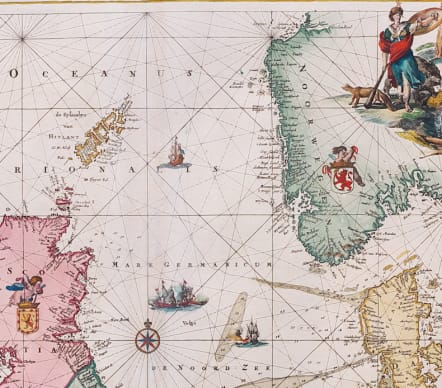
This beautiful sea chart of the North Sea includes the British Isles, the Faroe Islands, and the stretch of coastline extending from Norway south to Normandy. It includes two compass roses and is crisscrossed by rhumb lines. The seas are filled with sailing ships and a naval battle, and putti hold aloft the coats of arms of Ireland, Scotland, England, and Norway. Soundings appear throughout. There is a Dutch title cartouche at top right that features Athena with a fox and a bear and a logging scene. An additional Latin title cartouche at bottom right shows various allegorical figures including Neptune, Urania, and the States Lion with his sword and arrows.
Likely engraved by Romeyn De Hooghe.
Excellent colour
Very good condition
References: Carhart #C9.1; Shirley (BI to 1750)
Publication Atlas de Navigation et du Commerce Qui Se Fait Dans Toutes Les Parties Du Monde L Renard 1715 Amsterdam
code : M5520
Cartographer : WIT Frederick De
Date : 1675 / 1715 Amsterdam
Size : 50*58 cms 51.5*62 cms
availability : Available
Price : £2000
Frederick De Wit (1610-1698) was a prolific Dutch engraver and publisher, active in Amsterdam in the second half of the seventeenth century. He acquired a number of copperplates from the sale of the Blaeu and Jansson stocks to supplement his own plates, thus having a stock of about four hundred maps. De Wit’s own maps are noted for the fine standard of engraving, invariably well designed and decorative. They were very popular amongst his contemporaries, being reprinted many times both by himself and his successors, the Mortiers.