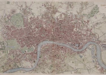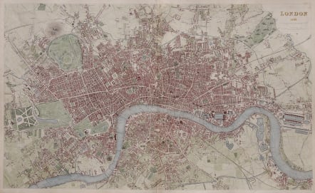
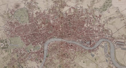
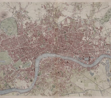
LONDON 1843 B DAVIES SDUK
£445
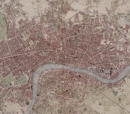
Attractivel oversize SDUK map of London clearly dated in the upper right corner. This map was 'drawn and engraved from authentic documents and personal observation' by B. R. Davies.
Detailed map showing the old Penitentary at Chanter & Wilton (along the Thames) Kensington Gardens, Hyde Park, the Palace Gardens, St.James Park; Grosvenor, Berkeley, Hanover, Cavendish and Bedford Squares (along with many others) the old Grand Junction Canal; tracks the route of the Great Western Railway; Regents Park and the Botanic Gardens (and the Hereford Marquis) the Foundling's Hospital at the end of Red Lions Street, the old "Model Prison" by the Caledonia Asylum north of Edwards Terrace and Park Street South; the New Cattle Market by Brick Fields; Victoria Park and Regent's Canal; plots the course of the Eastern Counties Railway and Whitechapel Road; Southwark and London Bridges (and many others; including the Tunnel!) the West India Import & Export Docks; the Grand Surrey Canal and the Stangate Glassworks.
Good hand colour
Very good condition
code : M5530
Cartographer : S.D.U.K
Date : 1843 London
Size : 39*64cms
availability : Available
Price : £445
The Society For The Diffusion Of Useful Knowledge was founded by John, Earl Russell, and Henry Brougham, later Lord Chancellor of England in 1827. The Society’s main purpose was to encourage universal literacy by publishing numbers of books of good quality that would be affordable to the poor. Perhaps the grandest of their publications was their atlas, originally entitled “Maps Of The Society For The Diffusion Of Useful Knowledge”, first issued by Baldwin and Cradock, and then re-issued by other publishers, latterly Edward Stanford.