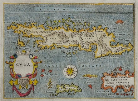
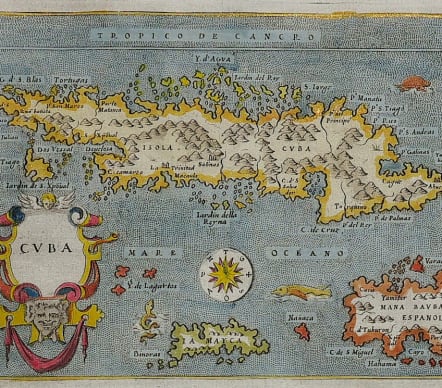
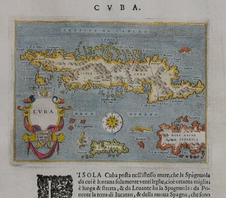
CUBA DESCRITTIONE DE L'ISOLA CUBA
Sold
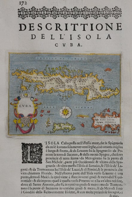
DESCRITTIONE DE L'ISOLA CUBA
Early detailed and attractive map of the island is based on the cartography of Giacomo Gastaldi. The map includes Jamaica and part of Hispaniola. The Ye de Lagartos, shown north of Jamaica, is one of the earliest references to the Cayman Islands to appear on a map. The map was graphically engraved by Girolamo Porro, with a stipple engraved sea embellished with sea monsters, a sea turtle, a compass rose, and a title cartouche. It is from one of the most famous Isolarios (Island Books) produced in the 16th century. Printed on a full sheet of Italian text with a historiated initial; title above map, Descrittione Dell' Isola Cuba.
Very good hand colour
Excellent condition.
Publication: L'Isole piu Famose del Mondo
Ref: Cueto #6; King (2nd Ed.), p. 57-59.
code : M5070
Cartographer : PORCACCHI Tomaso
Date : 1590c Venice
Size : 11*15 cms sheet 29*20 cms
availability : Sold
Price : Sold
Tomaso Porcacchi of Castiglione Aretino [1530-1585]. Italian. Published "L'Isole piu famose del Mondo" Venice, from 1572