GALLIA ODER FRANCKRYCH
Sold
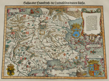
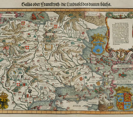
Full Title Gallia oder Franckrych / Die Landtafel des dritten Buchs
One of the rarest maps of France and certainly the most decorative. A plethora of heraldic shields, sea monsters and galleons.
Published in the Schweitzer Chronik. The map is probably taken from an earlier map by Sebastian Münster, but is much changed and far more sought because of all the decorations.
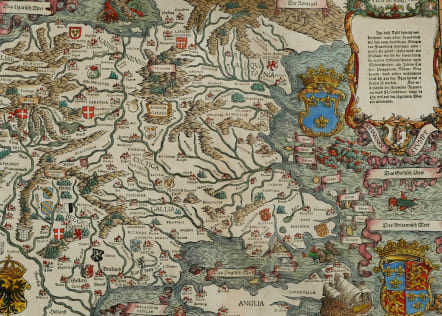
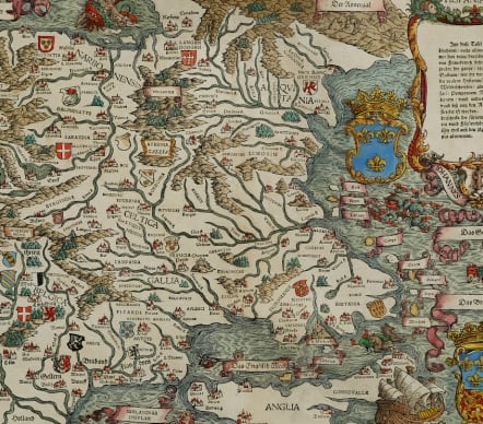
Very early wood cut printed map of France with South to the top. In the top left corner we see Provence and Southern England at the bottom right.
The seas are filled with sea monsters and sailing ships. According to van der Heijden after the map of Europe by Waldseemüller-Münster.
Engraved in 1548 Included in " The maps are prepared by Johannes Stumpf (1500-1576) and the maps are engraved by Heinrich I. Vogtherr (1490-1556) from Strassburg.
The atlas was basically the first atlas of Switzerland and one of the first, if not the first, national atlases of any European country.
Closed tear bottom centre just encroaching but near invisible
Excellent hand colour
Very good condition
code : M5157
Cartographer : STUMPF J
Date : 1548 /
Size : 30*42 cms
availability : Sold
Price : Sold