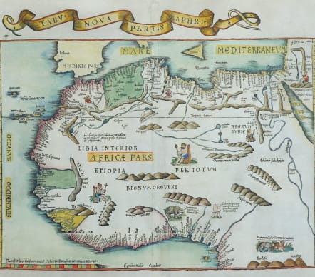
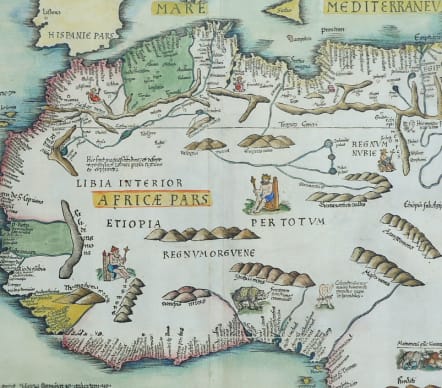
TABU NOVA PARTIS APHRI
£1250
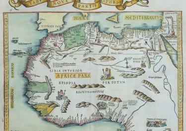
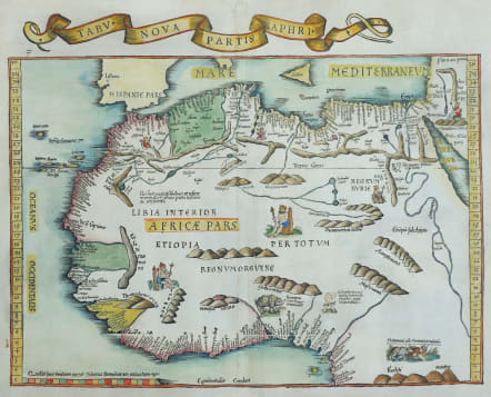
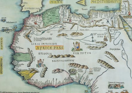
Stunning example of the 1535 edition of Lorenz Fries modern map of the northern part of Africa, the second earliest modern map to focus on the southern part of the Continent.
First published in Strasbourg by Johannes Gruninger in 1522, Fries map is based upon Waldseemuller's map of 1513.
The Fries map, documenting the northern and western parts of Africa, has been heralded as the second "modern" printed map of the continent. In this context, "modern" refers to a map grounded in contemporary knowledge of the period in which it was created. The map's foundation lies in a slightly earlier map by Martin Waldseemüller, published in 1513, which is recognized as the first modern printed map of Africa.
Though Fries' map drew from Waldseemüller's larger print, it was not a mere replication. Fries adapted it, incorporating iconographic images and other new details. The sources for these maps were diverse, including Ptolemaic traditions, Portuguese maritime charts, and narratives of explorers and travelers.
Superb hand colour
Very good condition
code : M5290
Cartographer : Fries Waldseemuller Ptolomy
Date : 1535
Size : 32*40.5 cms sheet 38*47 cms
availability : Available
Price : £1250
Early Ptolomaic map publishers and cartographers