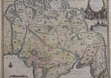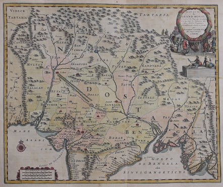
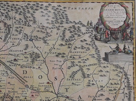
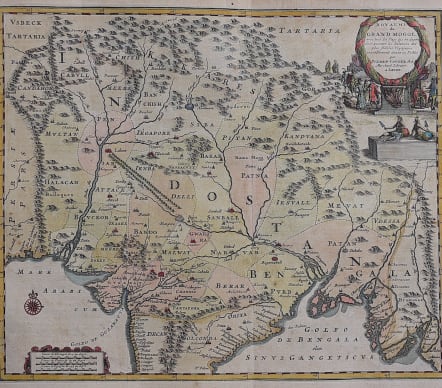
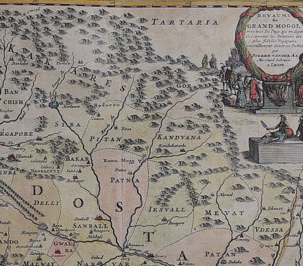
ROYAUME DU GRAND MOGUL
£265
Attractive original copper engraved antique map of Northern India, the Mogul Empire, was published by Peter Vander AA in 1720.
Finely engraved map of Northern India and todays Pakistan and Kashmir showing the mountains, rivers, cities, shrines, and roads. Decorative pictorial title cartouche, strapwork distance scales and compass rose embellish the map.
Good hand colour
Very good condition
code : M3586
Cartographer : Pieter Van Der AA
Date : 1720c Leiden
Size : 31*37 cms
availability : Available
Price : £265
Pieter Van Der Aa (1659-1733)
Van Der Aa was a prolific publisher, working in Leiden during the first three decades of the eighteenth century. Much of his output consisted of re-issues and re-engravings of map and view plates that he had acquired from earlier mapmakers. Little of his output was original, though that which is has a very distinct style, precisely and elegantly engraved, and is much sought-after today.
Perhaps his most remarkable publication was the elaborate Galerie Agreable Du Monde, issued in 1729, in 66 parts, bound into 27 volumes, which contained about 3,000 plates, apparently limited to 100 sets. Another of his extensive publications was the Cartes Des Itineraires Et Voyages Modernes, a collection of 28 volumes of travel accounts, illustrated with a series of small, but finely engraved maps, often with decorative pictorial title-pieces.
An interesting feature of Van Der Aa's method is that several of his atlases include maps printed within large, separately engraved, elaborately designed mock-frame borders, which were prepared with a blank centre so that individual maps could be over-printed on that area.
Despite the quantity and variety of Van Der Aa's publications they seem to have had only a limited circulation, and so are now scarce.