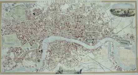
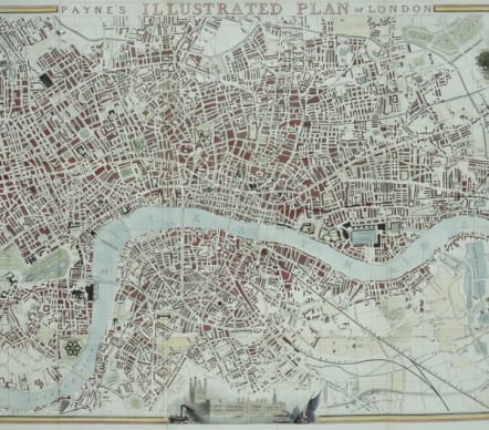
PAYNE'S ILLUSTRATED PLAN OF LONDON
£685
Rare.
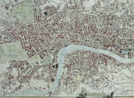
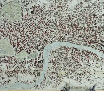
An attractive, large and detailed map of the capital, extending from Pentonville to Poplar, Peckham and Paddington and the Kings Rd and Chelsea. With fine vignette views of London from Hampstead Heath and also the Houses of Parliament. Lithographic print.
Excellent hand colour.
A beautiful map of London in very good condition.
Ref: Howgego, Printed Maps Of London, 402
code : M5273
Cartographer : Payne A H
Date : 1846
Size : 43*77 cms
availability : Available
Price : £685

British Isles