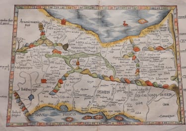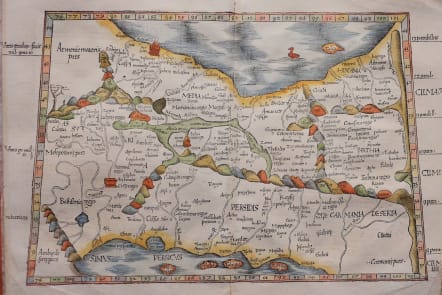
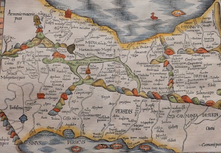
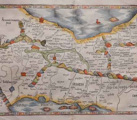

PERSIA FRIES TABULA V ASIAE
£725
Attractive woodcut map after Ptolemy by Lorenz Fries published by Grueninger in Strasbourg 1525
Important early map of the region between the Persian Gulf and the Caspian Sea, extending from Armenia and Mesopotamia eastward. On the left Armenia, Mesopotamia, and Babilonia Regio (the Fertile Crescent) and Babylon Tigris river all named.
First edition reduced reengraving Fries map from the Waldseemuller's Atlas, one of the most sought after of all editions of Ptolemy.
Superb hand colour
Mint condition
References: Mickwitz & Miekkavaara #208-19.
code : M5000
Cartographer : FRIES Lorenz
Date : 1525 Strabourg
Size : 32*48 cms
availability : Available
Price : £725
Laurent Fries (*1485 - †1532)
Laurent Fries was a French physician and mathematician born around 1485 in Mulhouse. He settled finally in Strassburg where he meat Peter Apian and the publisher Johannes Grüninger which made him interested in the Ptolemy Atlas of 1513 and 1520. Fries made new woodcut maps in reduced size. His Ptolemy Atlas was published first in 1522, reissued in 1525, 1535 and 1541. He died in 1532.