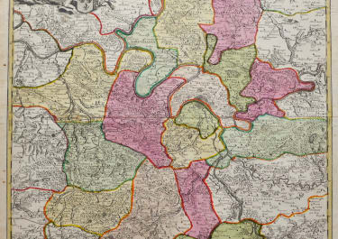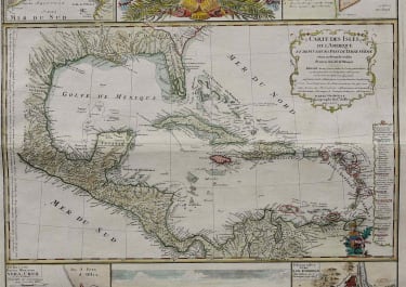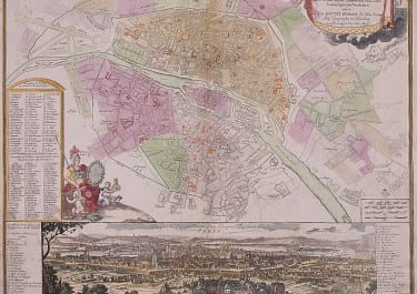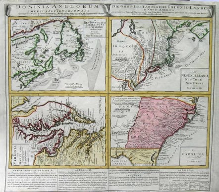
NORTH AMERICA DOMINIA ANGLORUM IN AMERICA SEPTENTRIONALI
£775
A very good example of the Homan Heirs 1737 map of the British Territories in North America. Divided into four separate maps derived from the work of Herman Moll. Covers much of the eastern coast of North America including Nova Scotia & Newfoundland, New England (New York, New Jersey, Massachusetts, Pennsylvania, etc..), Virginia & Maryland, and Carolina ( now North Carolina, South Carolina, Georgia) and northern Florida. The upper left quadrant features a map of the Maritime Provinces of Newfoundland and Nova Scotia. Offers wonderful detail both inland and offshore, with special attention to the shoals. Upper right hand quadrant features much of New England, New York and parts of Pennsylvania and New Jersey. The Jerseys are shown spit into eastern and western provinces according to their original charters. New York extends northward past Lake Champlain, which is itself set significantly south and west of its actual location. Notes Albany. Lower left quadrant features a map of those parts of Virginia and Maryland adjoining the Chesapeake Bay. Lower right quadrant features much of what is today North Carolina, South Carolina, Georgia, Alabama and Northern Florida. Notes land dispute with the Spanish territories with regard to the rights to Northern Florida, referencing various charters to the Carolinas. Predates Georgia. Excellent detail both inland and along the coast. Bounded on the western end by the Appalachian Mountains. Below the map is a large text area with notations on the land and peoples depicted, including a special commentary dedicated to the Iroquois Nation.Full original colour.Slight stain invisible on map. The Cartography of North America: 1500-1800, CXXIII. Phillips, P.L. (Atlases) 586, #148.code : M1658
Cartographer : Homann Family
Date : 1737 Nurenberg
Size : 50*55cms
availability : Available
Price : £775
Johann Baptist Homann (1664-1724) started his career in Amsterdam as an apprentice with the Danckerts family before returning to Nuremberg to establish himself in business in 1702.
The firm quickly became the principal geographical publishers in Germany and in 1715 Homann was appointed Geographer to the Holy Roman Emperor and he was also a member of the Prussian Royal Academy of Sciences.
His publications included the "Neuer Atlas Ueber Die Gantze Welt ..." in 1707-. The "Grosser Atlas ..." of 1716- and the "Atlas Novus Terrarum Orbis Imperioa" in c.1720, as well as many others. Johann died in 1724 and was succeeded by his son Johann Christoph who died in 1730. After his death the firm took the name Homann's Heirs and continued thereafter until 1813. Publications with the Homann's Heirs' imprint included the "Grosser Atlas" in 1731, Doppelmays'r "Atlas Coelestis ..." in 1742 and the "Atlas Geographicus Maior ..." in 1753-, amongst others. Throughout this entire period the firm were the leading map publishers in Germany, employing a number of very important cartographers