OCEANIQUE ORIENTE
£120
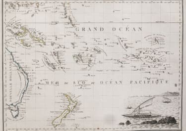
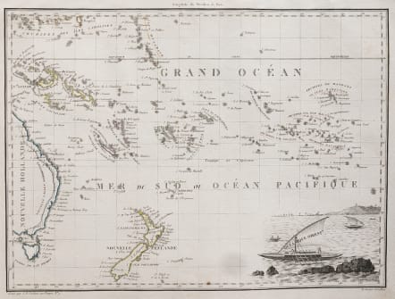
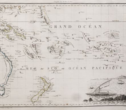
Intereasting map of the southern Pacific ocean, with New Zealand bottom centre. In lower right hand corner a vignette view of a Pacific sailing craft.Interesting decorative and rare map of western New Zealand, eastern Australia and southern Oceanie.
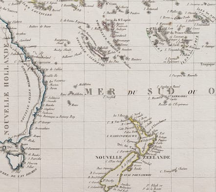
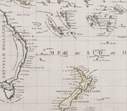
Very interesting for New Zealand in as much that North & South Islands are named as
Eaheinomauwe and Tavai Poenammou. Incomplete south island coast.
From Conrad Malte-Brun's Atlas complet du Precis de la Geographie Universelle. Engraved by Chamouin.
Lapie's map features an attractive vignette based on illustrations by Lesueur. Charles Lesueur was the young artist on Baudin's voyage, famous for his fine illustrations of Australian animals.
Pierre Lapie was the first geographer to the King of France and Chief of the Topographic section of the War Office.
Original colour. Cartouche.
Very good condition.
Engraved by J.B. Tardieu, after Giraldon for an Atlas by Lapie.
Original outline colour
Mint condition
code : M4178
Cartographer : LAPIE Pierre
Date : 1812 Paris
Size : 22*30 cms
availability : Available
Price : £120
Pierre M. Lapie (fl. 1779 - 1850) and son Alexandre Lapie (fl. 1809 - 1850) were French cartographers and engravers active in the early part of the 19th century. Lapie (Pierre), cartographer, born at Mezieres in 1771, died in 1850, was admitted in 1794 to the corps of topographical engineers, in that capacity he made several campaigns, rose to the rank of Colonel of Staff, and in 1814 became director of the topographical cabinet of the king, was, from 1818 he was responsible for the direction of the new topographic map of France, and had the greatest part in the execution of this magnificent work. He published a classic Atlas (1812), which was improved in several successive editions, and a Universal Atlas of Ancient and Modern Geography (1828), one of the best of his era.