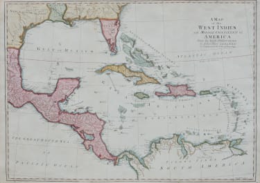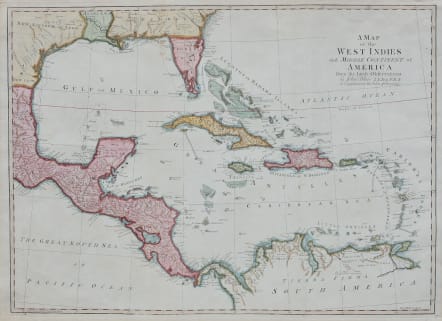
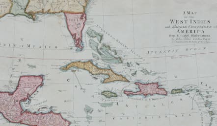
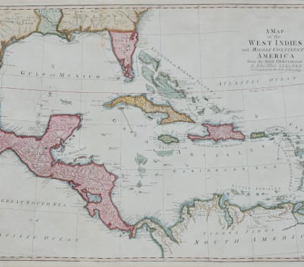
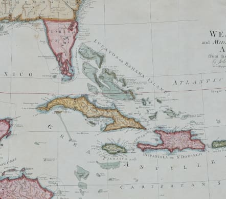
A MAP OF THE WEST INDIES AND THE MIDDLE CONTINENT OF AMERICA
£250
Large attractive map of the whole of the West Indies,Mexico,Texas and Florida.
From the atlas by John Blair, a fascinating oeuvre which was created for and dedicated to Augusta, Princess Dowager of Wales, in 1779.
Detailed map of Florida, the Gulf Coast and Caribbean, centered on Cuba colored by regions. Florida is shown as an Archipelago. Georgia extends to the Mississippi River.
Massive Kingdom of Leon (Texas). Nice detail in the Bahamas.
Very good hand colour
Map is in excellent condition
WAS £365 SALE PRICE £250
code : M5174
Cartographer : KITCHIN Thomas
Date : 1790
Size : 42*68cms
availability : Available
Price : £250
Thomas Kitchin (1718-1784) was one of the best and most prolific engravers of the eighteenth century. He issued The General Atlas, Describing the Whole Universe , first published in 1773, and regularly reissued thereafter. His work also included a large number of maps of the English counties, particularly for the London Magazine (1747-1760), the Universal Magazine (1747-1766), and for Dodsley’s England Illustrated (1764). Other maps were published in conjunction with Emanuel Bowen in the Large English Atlas and the Royal English Atlas (1763).