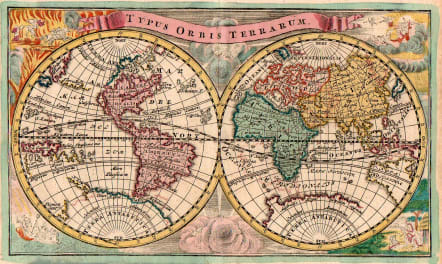
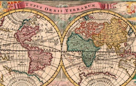
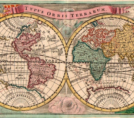
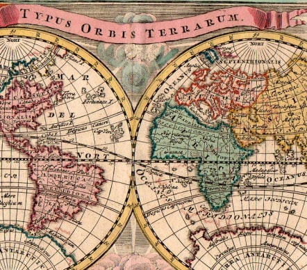
TYPUS ORBIS TERRARUM
Sold
Attractive and rare World map by Weigel and published by Adam Friedrich Zurner in Nuremberg.
California shown as an island with a narrowing, irregular northern coast, substantial portions of a conjectural Antarctica, much of Australia and Terra Iesso, a continuous landmass extending from Japan to California, along with a Northwest Passage. Allegorical figures in the corners represent fire, air, earth and water, while figures representing the winds are above and below centre.
Original hand colour
Mint condition for this rare map
code : M4436
Cartographer : WEIGEL Christoph
Date : 1745
Size : 18*22 cms
availability : Sold
Price : Sold
Christoph Weigel (c.1654-1725) and his relation Johann Weigel worked out of Nuremberg in the first half of the eighteenth century. Weigel is also known for a number of maps featuring in Faber’s “Atlas Scholasticus” (1718) and also the “Schul- Und Reisen Atlas”, produced in conjunction with JD Köhler.
Weigel was also involved with Köhler’s “Descriptio Orbis Antiqui” published c.1720. This volume contained in total forty four well engraved maps of the ancient world, many decorated with vignettes illustrating coins, medallions and mythological scenes.