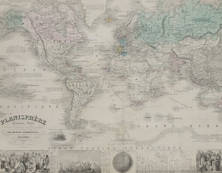
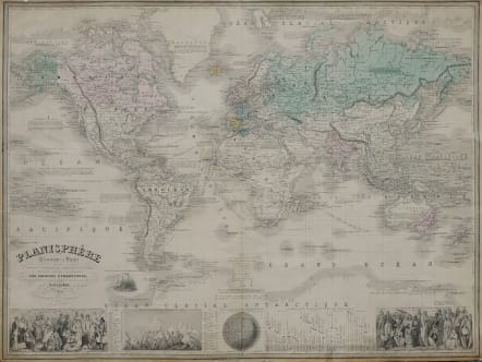
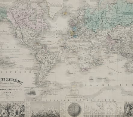
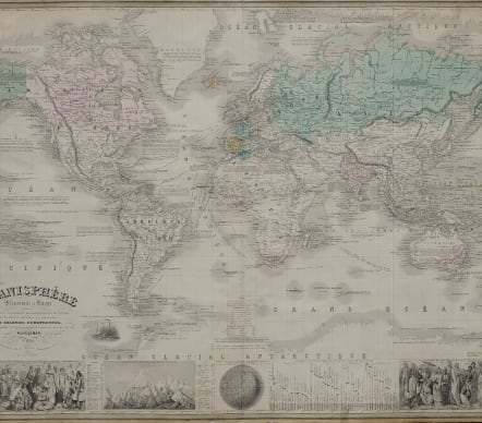
PLANISPHERE ELEMENTAIRE ET ILLUSTRE
£350
A most decorative large mid 19th century world map on Mercator's projection. A panel at bottom features vignette engravings of the races of man, heights of mountains and lengths of rivers. The map is filled with an impressive array of information illustrating the physical and geographical divisions, shipping routes, colonial possessions, roads and railways, and numerous informative notations.
The text is engraved in steel by Gérin, and the map by F.Lefévre. The illustrations are after a design by A.Testard and are engraved by Guesnu.
Steel engraved map, a good and dark impression. Lithographic colour demoting the European colonies in the mid nineteenth century.
Laid down on archival paper, some nicks in margins encroaching into printed surface.
Good condition for this uncommon large World map
code : M5152
Cartographer : Vuillemin.A
Date : 1861 Paris
Size : 65*85 cms
availability : Available
Price : £350