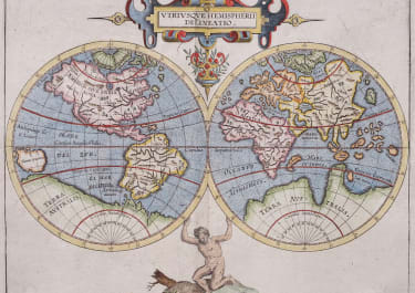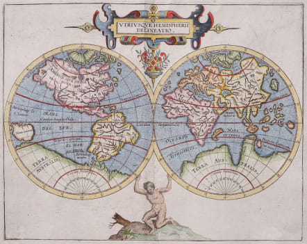
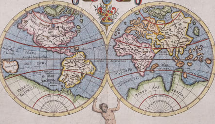
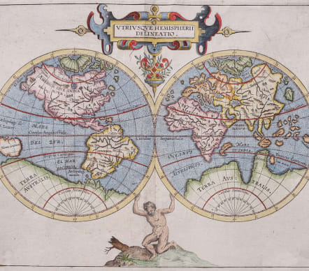
ULTRIUSQUE HEMISPHERII DELINEATIO
£1250
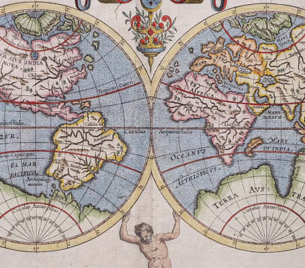
Scarce antique map of World by Cornelis van Wytfliet.
This important and historic map is from Cornelis van Wytfliet's Histoire Universelle des Indes Occidentales. The geography for this map came from Rumold Mercator's map of 1587 and is reduced in size.
The map was issued in 1597, just as important cartographic advancements were resulting from the voyages of Linschoten, Barentsz, Houtman, and others. Despite this, it relies on earlier information, namely the Mercator world referenced earlier. The New World maps within the same work were in part derived from the 1592 Plancius world.
In the Arctic, Wytfliet follows the Mercator model, with four main islands around the Pole, Nova Zemblaya is merged with one of the islands, an error that would be corrected by Barentsz.
The map includes a vast Terra Australis stretching across the entire southern quarter.
Excellent later hand colour
Very good condition.
code : M5227
Cartographer : Wytfliet, Cornelis van
Date : 1597 Louvain
Size : 23*29 cms sheet 28*32 cms
availability : Available
Price : £1250
Antique Maps by Cornelius Wytfliet (*1550 - †1597)
Cornelius van Wytfliet, also known as Cornelis van Wytfliet, was a Flemish cartographer. His Atlas of America with 19 double page engraved maps made him famous today. First published in 1596 in Leuven (Louvain), Flanders in Latin with the title Descriptionis Ptolemaicae Augmentum. The accuracy of some of the maps is still a mystery today. Especially the course of the north coast of North America, the Antarctica and various river courses are reproduced quite accurately, and this before - according to today's knowledge - any European has ever seen these regions.