ORBIS TERRARUM TYPUS DE INTEGRO IN PLURIMIS ...
Sold
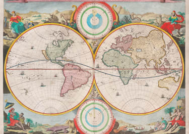
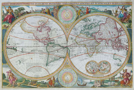
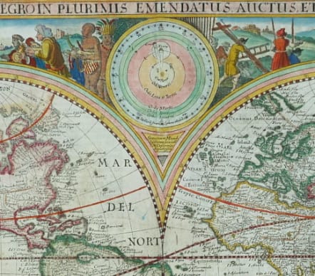
Full Title ORBIS TERRARUM TYPUS DE INTEGRO IN PLURIMIS EMENDATUS, AUCTUS, ET ICUNCULIS ILLUSTRATUS
A Visscher Bible map. circa 1660 second state of the 1650 map.
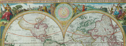
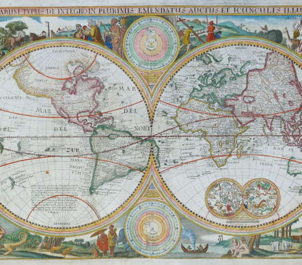
This map is a direct derivative of Nicolas Visscher's first world map designed for inclusion in Dutch Bibles. It has been re-engraved, is nominally larger, and this example is from a German Bible. Identical engravings including allegorical representations of the continents as well as native inhabitants and wildlife surround the double hemisphere world map. Two celestial spheres are displayed in the Eastern Hemisphere. In the lower part of the Western Hemisphere is text describing the discovery of America and recent voyages of discovery. Two diagrams depicting the Ptolemaic and Copernican theories of the solar system are tucked between the hemispheres. The northwest coast of North America is exaggerated and shows California correctly as a peninsula. Parts of Australia and Van Diemen's Land are shown but the north coast of Australia is not depicted. It also includes the western coastline of New Zealand. German text on verso. Shirley notes several derivatives in his Corrigenda and Addenda (2001 revised edition of The Mapping of the World). This most closely matches #414A, although there is no additional outer scroll border.
Excellent hand colour
Very good condition
References: Shirley #414.
code : M5288
Cartographer : Nicolaas VISSCHER
Date : 1660c
Size : 31.5*48 cms sheet 36.5*49.5 cms
availability : Sold
Price : Sold
Among the many great Dutch map publishers active in the seventeenth century were the Visscher family; the firm was begun by Claes Jansz Visscher (1587-1652), and subsequently included his son Nicolaas (1618-1679), grandson Nicolaas II (1649-1702) and then his grandson’s widow, Elizabeth, until her death in 1726.
Although mainly art dealers, the Visschers were prolific publishers, producing individual maps and also atlases made up to their customers’ specifications. Indeed, they are commonly regarded as second only to the Blaeus among Dutch map-makers for the high quality of engraving and decoration and the geographical accuracy of their many maps. Particularly outstanding - not only as maps but as works of art - are their world maps.