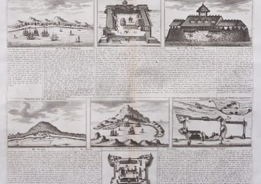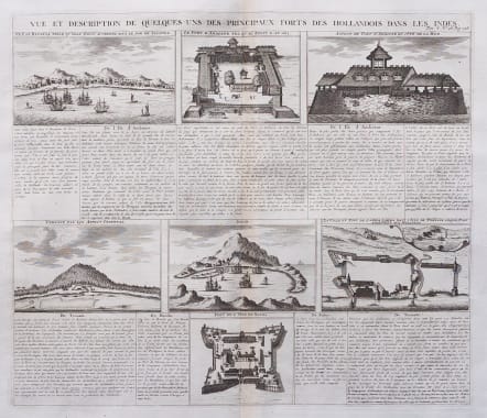
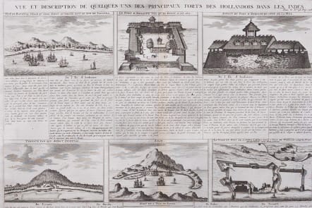
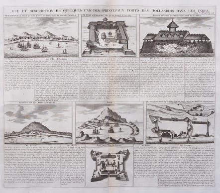
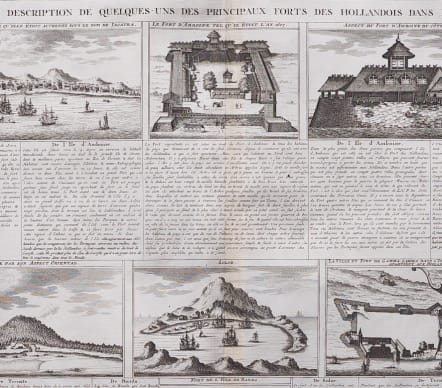
VUE ET DESCRIPTION DE QUELQUES UNS DES PRINCIPAUX FORTS DES HOLLANDOIS DANS LES INDES
£95
Large folio copper engraving interest to the Dutch East India Company
Interesting sheet with seven detailed views illustrating the most important Dutch trading outposts and fortified colonial possessions in the East Indies, including four harbour views Batavia (Jakarta), Amboina, Ternate, and Solor, and three fort plans, with descriptive French text, from Chatelain's monumental seven volume 'Atlas Historique'.
Uncoloured as issued
Very good condition
code : M5564
Cartographer : CHATELAIN Family Henri & Zacharie
Date : 1719
Size : 37*43 cms sheet size 42.5*49.5 cms
availability : Available
Price : £95
Zacharie Chatelain (d.1723) was the father of Henri Abraham (1684-1743) and Zacharie Junior (1690-1754). They worked as a partnership publishing the Atlas Historique, Ou Nouvelle Introduction A L’Histoire … under several different Chatelain imprints, depending on the Chatelain family partnerships at the time of publication. The atlas was published in seven volumes between 1705 and 1720, with a second edition appearing in 1732. The maps were accompanied by information pertaining to cosmography, geography, history, chronology, genealogy, topography, heraldry, and costume of the world.