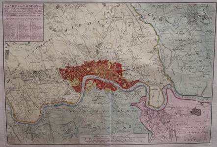
KAART VAN LONDEN
£395
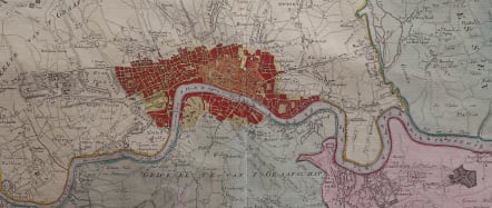
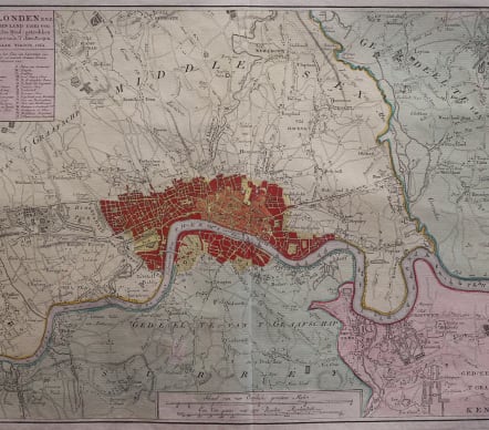
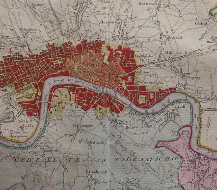
Full Title Kaart van Londen enz. en van het naby gelegen land ruim een uur gaans rondom dezelve stad : getrokken uit de groote gemeeten kaart van de Hr. John Rocque. [ca. 1:63.500]. Amstersdam : Isaak Tirion, 1754.
Very attractive mid eighteenth century map of London.
This map covers the area ten miles round the City of London and was published in Amsterdam by Isaak Tirion, his home town. Text describes the map as covering anhours walk around London.
Based on John Rocque's survey of 1744, the map's title, imprint and key appears in a table at top left. The scale bars are in a panel below the plan. Built-up areas are stippled in the City and hatched elsewhere.
Superb origibnal colour with central london coloured red as usual and wash colour for the areas around.
Mint condition for this rare map
code : M4404
Cartographer : Isaac TIRION
Date : 1754 Amsterdam
Size : 29*42 cms sheet 42*54 cms
availability : Available
Price : £395
Isaac Tirion (c.1705-c.1769) was born in Utrecht. He became a prominent bookseller and publisher with premises on the ‘Kalverstraat’ in Amsterdam and was also to become a member of the board of the booksellers’ guild. He was responsible for a large number of atlases and books with maps.