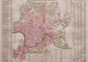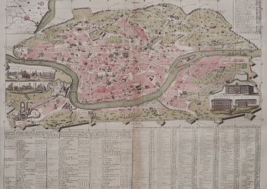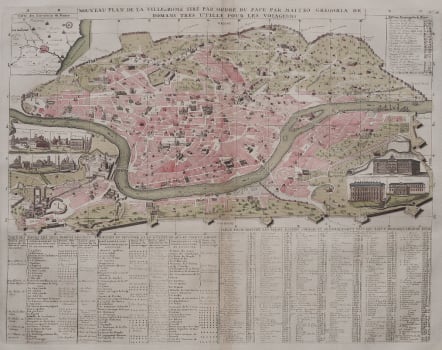
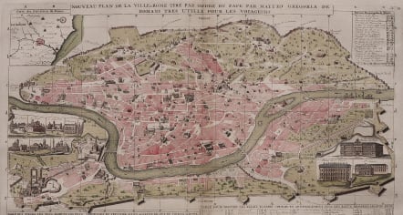
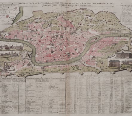
NOUVEAU PLAN DE LA VILLE DE ROME TIRE PAR ORDRE DU PAPE
£245
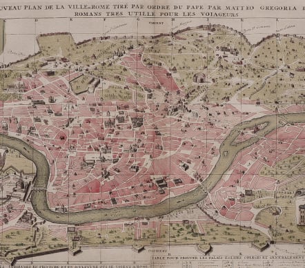
Full Title Nouveau Plan De La Ville De Rome Tire Pare Ordre Du Pape Par Mateo Gregoria De Romans Tres Utille Pour Les Voiageurs
This attractive & detailed map of Rome illustrates numerous important buildings located within the fortified city. The extensive table along the lower half keys specific "tourist" sights, residences, important buildings, etc. Two insets handsomely presented as unfurled scrolls show the elevation of the most important buildings including Palais du Pape, Palais de St. Pierre, Ste. Marie and several other churches. Plus a third inset is a map "Carte des Environs de Rome" and at upper right a table lists the churches of Rome. This handsome city plan is displayed in a partial birds-eye view perspective giving it a somewhat three dimensional feel. The map was really an early map for tourists as the full title says its is'tres utile pour les voyageurs'.Some attractive vignettes and the principal buildings shown on map.
Excellent original hand colour.
Very good condition.
References: Koeman - II, p. 35 Cha1 (18)
code : M5528
Cartographer : CHATELAIN Family Henri & Zacharie
Date : 1720 Amsterdam
Size : 33.5*44 cms sheet 44*49.5 cms
availability : Available
Price : £245
Zacharie Chatelain (d.1723) was the father of Henri Abraham (1684-1743) and Zacharie Junior (1690-1754). They worked as a partnership publishing the Atlas Historique, Ou Nouvelle Introduction A L’Histoire … under several different Chatelain imprints, depending on the Chatelain family partnerships at the time of publication. The atlas was published in seven volumes between 1705 and 1720, with a second edition appearing in 1732. The maps were accompanied by information pertaining to cosmography, geography, history, chronology, genealogy, topography, heraldry, and costume of the world.