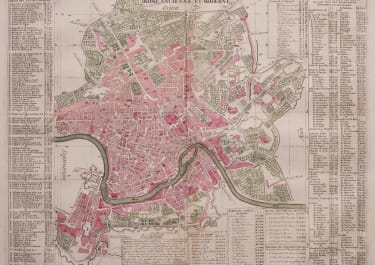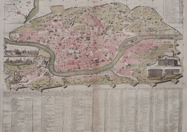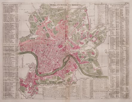
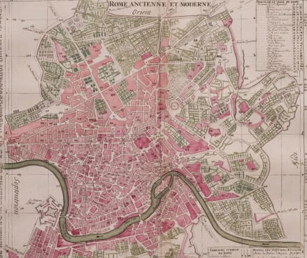
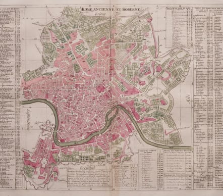
ROME ANCIENNE ET MODERNE
£245
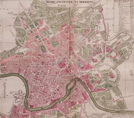
Attractive and detailerd plan of the city detailing the fortifications and ramparts in the southern part below the river. Numerous tables keyed to the map name hundreds of palaces, colleges, gardens, ancient ruins and monuments and other important buildings. A fascinating and uncommon map.
Good original hand colour
Very good condition
code : M5533
Cartographer : CHATELAIN Family Henri & Zacharie
Date : 1720 Amsterdam
Size : 34.5*44.5 cms sheet size 44.5*50 cms
availability : Available
Price : £245
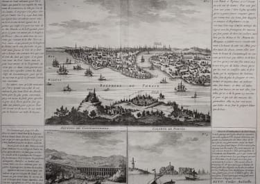
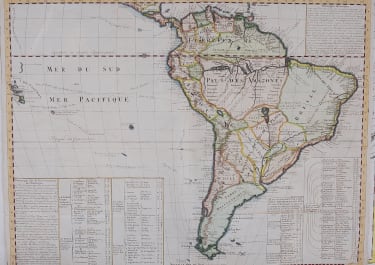
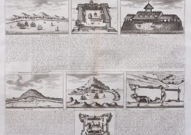
Zacharie Chatelain (d.1723) was the father of Henri Abraham (1684-1743) and Zacharie Junior (1690-1754). They worked as a partnership publishing the Atlas Historique, Ou Nouvelle Introduction A L’Histoire … under several different Chatelain imprints, depending on the Chatelain family partnerships at the time of publication. The atlas was published in seven volumes between 1705 and 1720, with a second edition appearing in 1732. The maps were accompanied by information pertaining to cosmography, geography, history, chronology, genealogy, topography, heraldry, and costume of the world.