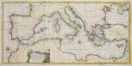
AN ACCURATE CHART OF THE MEDITERRANEAN AND ADRIATIC SEAS...
£450
An Accurate Chart of the Mediterranean and Adriatic Seas; with the Archipelago & Part of the Black Sea . . . 1748
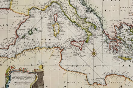
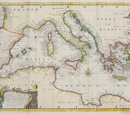
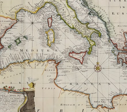
Superb chart of the Mediterranean. Excellent example of Bowen's map of the Mediterranean and contiguous regions, from Harris' Navigantorum. The map is done in the Portolano style, focusing on coastal features.
Many placenames and fine detail throughout. Rhum lines.
Decorative cartouche and 2 compass roses.
Extends from Cyprus and the Black Sea to beyond the Straits of Gibralter.
Excellent hand colour
Mint condition
code : M5040
Cartographer : Emanuel BOWEN
Date : 1748 London
Size : 29.5*58.5 cms
availability : Available
Price : £450
Emanuel Bowen (c.1693/1694-1767) was an English engraver, publisher and mapseller active in London between 1720 and 1767. His prolific output as engraver and publisher earned him recognition both in England and France, for he held the dual appointment of Engraver to George II and to Louis XV of France.
Bowen engraved large numbers of maps for general atlases, geographical text-books and periodicals, particularly The Complete System of Geography, the Universal History of the World, the small-format periodical The General Magazine of Arts and Sciences and the Complete Atlas.
Bowen also produced a large number of English county maps. His earliest known publication was a series of road maps of England and Wales, the Britannia Depicta, with a map of each county, produced in partnership with John Owen in 1720 (the Owen and Bowen maps). This series was very popular, being frequently re-issued up to 1764 and was the most successful successor to John Ogilby's renowned road book.