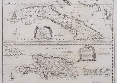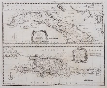
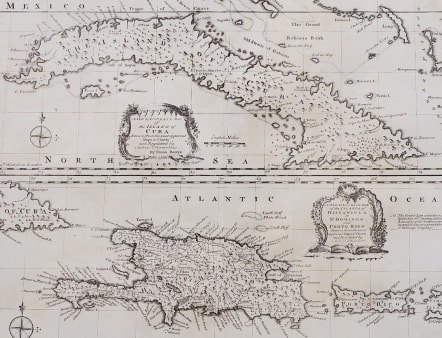
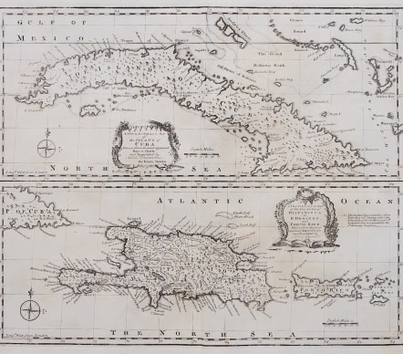
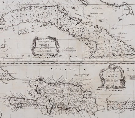
A NEW AND ACCURATE MAP OF THE ISLAND OF CUBA PLUS ISLAND OF HISPANIOLA
£350
Attractive and detailed maps of Cuba, Hispaniola and Puerto Rico, along with parts of the Bahamas.Decorative and interesting, with annotations in English.
Two maps on one plate of the largest Carribean Islands, Cuba above, Hispaniola below. Each map has its own cartouche. Emmanuel Bowen was one of the leading English mapmakers of the eighteenth-century, and was cartographer to both the French and English Royal Courts.
Uncoloured as issued
Mint condition
code : M5089
Cartographer : Emanuel BOWEN
Date : 1744 London
Size : 35*42 cms
availability : Available
Price : £350
Emanuel Bowen (c.1693/1694-1767) was an English engraver, publisher and mapseller active in London between 1720 and 1767. His prolific output as engraver and publisher earned him recognition both in England and France, for he held the dual appointment of Engraver to George II and to Louis XV of France.
Bowen engraved large numbers of maps for general atlases, geographical text-books and periodicals, particularly The Complete System of Geography, the Universal History of the World, the small-format periodical The General Magazine of Arts and Sciences and the Complete Atlas.
Bowen also produced a large number of English county maps. His earliest known publication was a series of road maps of England and Wales, the Britannia Depicta, with a map of each county, produced in partnership with John Owen in 1720 (the Owen and Bowen maps). This series was very popular, being frequently re-issued up to 1764 and was the most successful successor to John Ogilby's renowned road book.