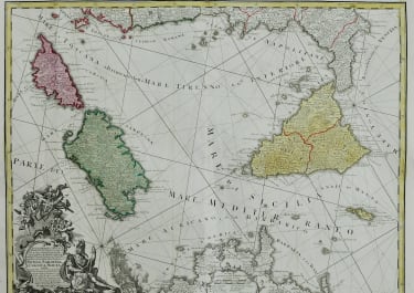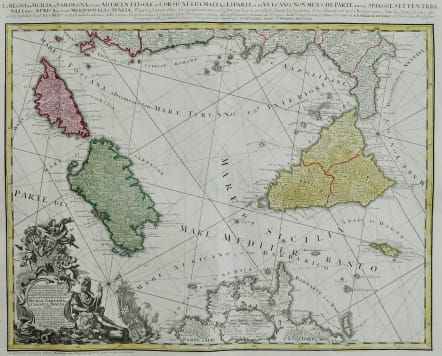
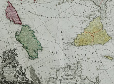


LA REGNI DI SICILIA E SARDEGNA COLLE ADIACENTI ISOLE DI CORSICA ..
£585
Full title: Li Regni di Sicilia, e Sardegna, colle adiacenti Isole di Corsica, Elba, Malta, e Liparee, o di Vulcano, non men che Parte delle Spiagge Settentrionali dell'Africa, e delle Meridionali d'Italia
Superb & sought after decorative antique chart of the southern boot of Italy in original colour.
With the islands of Corsica ( Corse ) , Sardinia ( Sardegna or Sardegna ), Sicily ( Sicilia ), Malta, Gozo and much more to the Gulf of Tunis and northern coast of Africa (Barbaria). Based on the work of Rizzi Zannoni. Dated in the top title to 1762. A highly decorative title cartouche at bottom left of this antique map contains angels carrying state coats of arms above symbols of war including a warship firing a salvo from its starboard side.
Good strong impression
Large carouche Rhum lines
Original hand colour
Very good condition
code : M5303
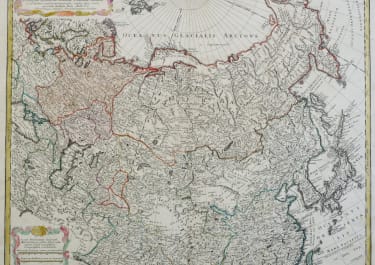
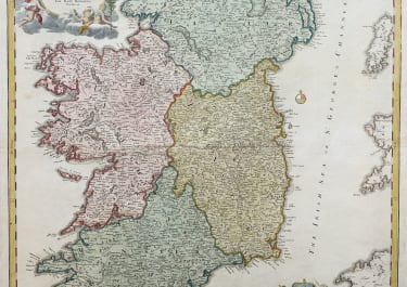
Cartographer : Homann
Date : 1762
Size : 50*59 cms
availability : Available
Price : £585
The Family HOMANN
Johann Baptist Homann (1664-1724) started his career in Amsterdam as an apprentice with the Danckerts family before returning to Nuremberg to establish himself in business in 1702. The firm quickly became the principal geographical publishers in Germany and in 1715 Homann was appointed Geographer to the Holy Roman Emperor and he was also a member of the Prussian Royal Academy of Sciences. His publications included the “Neuer Atlas Ueber Die Gantze Welt ...” in 1707-. The “Grosser Atlas ...” of 1716- and the “Atlas Novus Terrarum Orbis Imperioa” in c.1720, as well as many others. Johann died in 1724 and was succeeded by his son Johann Christoph who died in 1730. After his death the firm took the name Homann’s Heirs and continued thereafter until 1813. Publications with the Homann’s Heirs’ imprint included the “Grosser Atlas” in 1731, Doppelmays’r “Atlas Coelestis ...” in 1742 and the “Atlas Geographicus Maior ...” in 1753-, amongst others. Throughout this entire period the firm were the leading map publishers in Germany, employing a number of very important cartographers