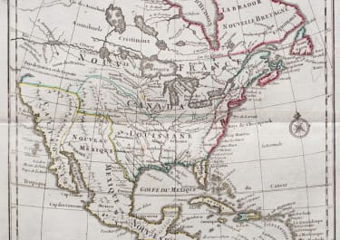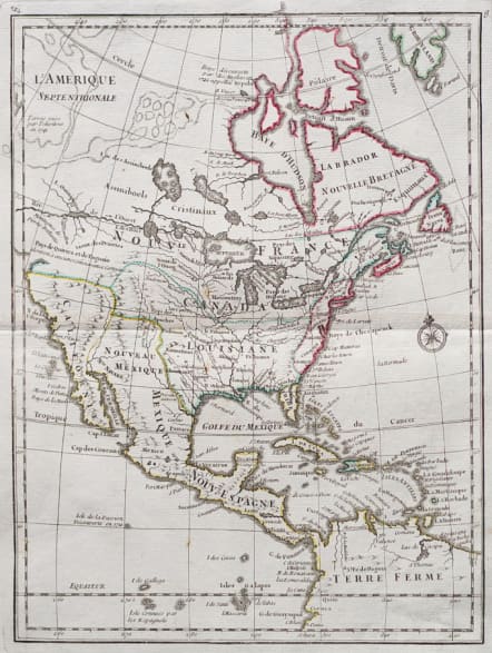

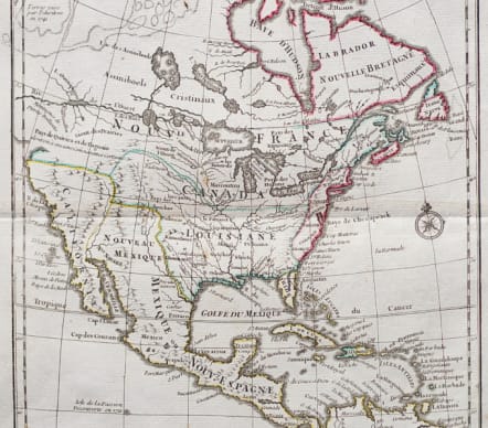

L'AMERIQUE SEPTENTRIONALE
£240
Interesting & unusual map of North America.
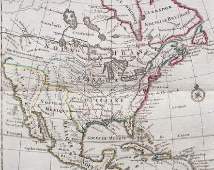
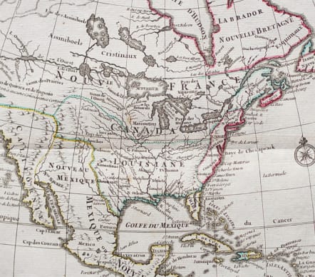
In north eastern part of North America some interesting lakes and rivers are drawn, with a note: Terres vues par Tchirikow en 1741. Tchirikow was a Russian explorer visiting the Bearing Straits...
The most prominent feature is a River of the West, which connects Lake Superior with the Lake of the Woods and Lake Winnipeg and then flows off the map supposedly to the Pacific.
Indian tribes. Interesting division of states on eastern seaboard.
Compass rose.
Original outline colour.
Mint condition.
Publication: Atlas nouveau portatif à l'usage des militaires et du voyageur, published in Paris in 1748.
code : M5432
Cartographer : ROUGE LE Georges-Louis
Date : 1748 Paris
Size : 28*21cms sheet size 33*24 cms
availability : Available
Price : £240
Lieutenant George-Louis Le ROUGE
Lieutenant George-Louis Le Rouge (c.1712-c.1790) was born in Hanover, Germany. He became a Lieutenant in the regiment of Saxe before establishing himself as a publisher, compiler and editor of maps in Paris. He later became the “Ingenieur Geographe de Roi”.
Le Rouge is particularly known for such atlas works as the “Atlas Nouveau” of 1746 and the “Atlas Nouveau Portatif ...” or the “Introduction A La Geographie” of 1756 – French publications of some merit.
Le Rouge was initially a military “Ingenieur” for fortifications and he was also a map-maker for the army and Marine Royale. He was active between 1740 and 1780, in Paris at, rue des Augustins.