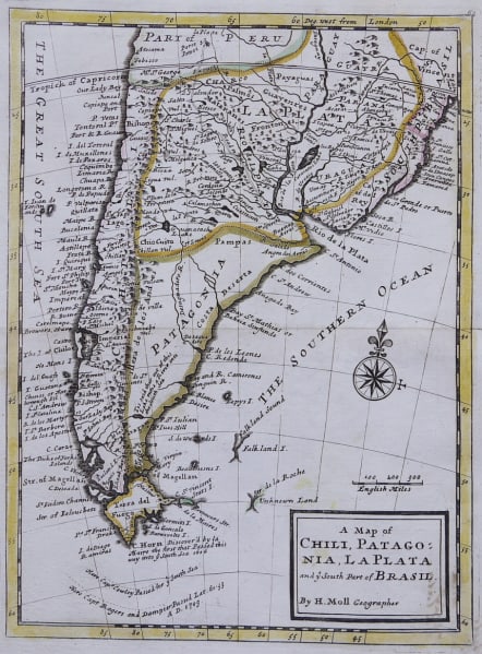
A MAP OF CHILI, PATAGONIA, LA PLATA AND THE SOUTHERN PART OF BRASIL
Sold
Uncommon map of the southern part of South America covering the countries of Chile, Patagonia and La Plata. Shows routes of Cowley and Dampier on their routes to / from the Pacific.
Compass rose, original outline colour.
Excellent condition.
Publication.. Atlas minor: or a new and curious set of sixty-two maps
Ref http://www.davidrumsey.com/luna/servlet/detail/RUMSEY~8~1~3769~430105:Map-of-Chili,-Patagonia,-La-Plata,-
code : M3275
Cartographer : MOLL Herman
Date : 1732 London
Size : 28*21 cms
availability : Sold
Price : Sold
Herman Moll (1654? - 1732) was an important 18th century map publisher and engraver based in London and Holland
He moved to London in 1680 where he worked as an engraver for Moses Pitt, among other London map publishers. Around the turn of the century, Moll set up his own shop where he produced a large corpus of work known for its high quality and decorative flair.