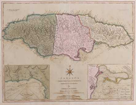
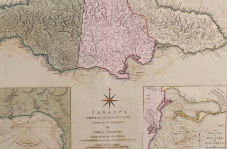
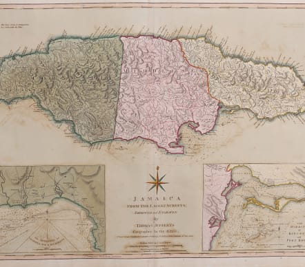
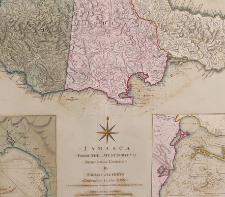
JAMAICA FROM THE LATEST SURVEYS IMPROVED AND ENGRAVED BY THOMAS JEFFERYS
Sold
Attractive example of Jefferys map of Jamaica published by Laurie & Whittle .
Showing parishes, towns, and villages, churches, forts, roads, rivers and ponds, harbors, anchorages, soundings, etc.
Includes an annotation at upper left: "The Negro-towns are Distinguished by a Stroke under the Name." Includes 2 large inset plans of the Harbours of Bluefields and Kingston and Port Royal. These inset maps are also extremely detailed including the names of some plantations.
First published in 1885 this map has some latest updates re anchorages etc.
Rare in that this map has full original wash colour and although there is some light offsetting the original colour makes it one of the most attractive maps of Jamaica available.
Very good condition
code : M4026
Cartographer : Jefferys T
Date : 1775 . 1810 London
Size : 47*63 cms
availability : Sold
Price : Sold