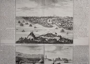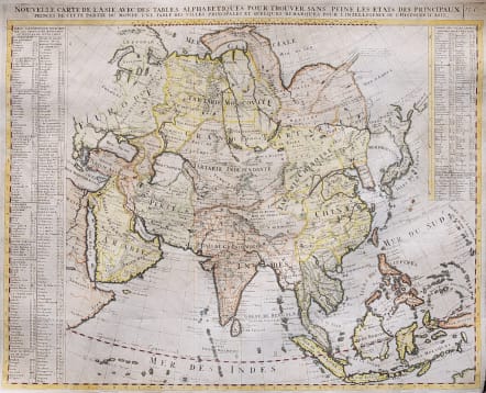
NOUVELLE CARTE DE L'ASIE..
Sold
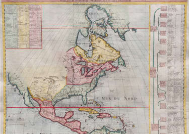
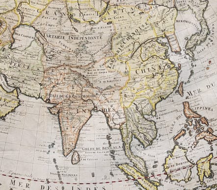
Full title Nouvelle Carte de l' Asie avec des Tables Alphabetiques pour Trouver sans Peine les Etats des Principaux Princes de Cette partie du Monde
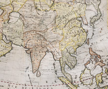
Fine map of Asia and the East Indies with extensive internal political and geographical details. This map is based on Delisle's general map of Asia with Nova Zemla shown connecting to the continent and Witsen's mountainous peninsula with a note that it is not certain where this point of land ends. Hokkaido (Terre de Yeco) is attached to Japan and separated from the mainland by a narrow Detroit du Jessor. The southern coast of Terre de la Compagnie appears to the east of Hokkaido. The map extends to include all of the East Indies, the Maldives, part of New Guinea, Arabia and the Red Sea. Keys at left and top right sides record the countries, principal cities and major rivers of Asia.
Excellent hand colour
Very good condition.
code : M3643
Cartographer : CHATELAIN Family Henri & Zacharie
Date : 1705 Paris
Size : 47*58 cms
availability : Sold
Price : Sold
Zacharie Chatelain (d.1723) was the father of Henri Abraham (1684-1743) and Zacharie Junior (1690-1754). They worked as a partnership publishing the Atlas Historique, Ou Nouvelle Introduction A L’Histoire … under several different Chatelain imprints, depending on the Chatelain family partnerships at the time of publication. The atlas was published in seven volumes between 1705 and 1720, with a second edition appearing in 1732. The maps were accompanied by information pertaining to cosmography, geography, history, chronology, genealogy, topography, heraldry, and costume of the world.