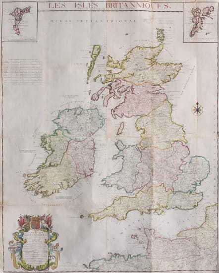
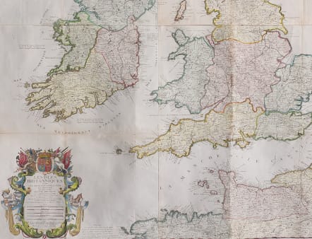
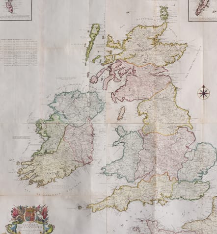
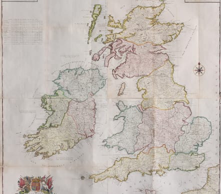
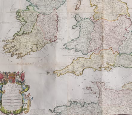
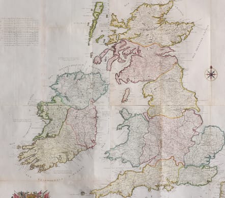
LES ISLES BRITANNIQUES PAR L.C. DESNOS GEOGRAPHE DE SA MAJESTE DANOISE
£1450
Stunning large wall map of the British Isles by Desnos.
Scarce map
Les Isles Britanniques, où sont les Royaumes d'Angleterre et d'Ëcosse, que nous appellons Grande-Bretagne et celey d'Irlande.
A large and colourful map of the British Isles, marking the major roads, with insets of the Shetlands and Orkneys and a large title cartouche.
4 folio sheets; here the top 2 and bottom 2 have been joined ( But top and can be joined if wanted or sent to be joined by framer)
Flattened folds ... Not laid down
Very good hand colour
Good condition
code : M4640
Cartographer : DESNOS Louis
Date : 1778 Paris
Size : 107*85 cms
availability : Available
Price : £1450
Louis Charles Desnos (1728-1805) was a renowned mapmaker, globemaker and publisher of Paris. Throughout his considerable career Desnos worked with most of the eminent cartographers of his day. He came to control plates by Buy de Mornas, Brion de la Tour and Robert de Vaugondy amongst others and re-issued works by de Fer and Le Rouge. All this at a time when Paris could still be regarded as one of the largest centres of European map production.
Desnos first continued to work at the Hardy place in the rue Saint-Julien-le-Pauvre in Paris, but in 1757, when he became a freeman, he moved to a new place, at the sign of the Globe in rue Saint-Jacques.
From 1759 he called himself 'ingénieur-géographe et libraire du roi de Danemark'. In the 1760's Desnos extended his activities as a publisher of maps and books. Globe making became less important for him, perhaps because of the success of his main competitor Didier Robert de Vaugondy.
Desnos’ works included a wide variety of cartographic subjects. Notable works include the “Petit Atlas Elementaire …” (c.1865) and the “Atlas National Et Génèral De La France” (1790) as well as many more.