NOUVELLE CARTE D'ANGLETERRE D'ECOSSE ET D'IRLANDE ...
Sold
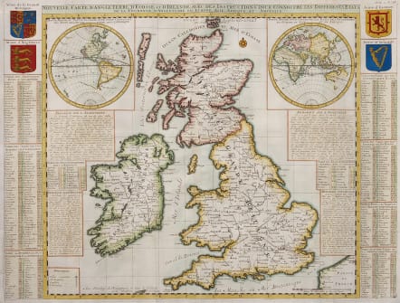
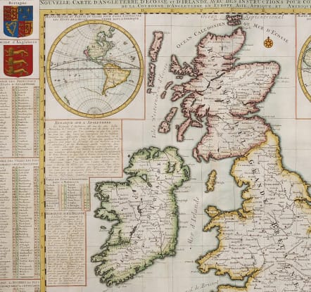
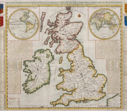
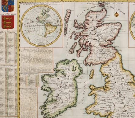
Full Title :Nouvelle Carte D'Angleterre, D'Ecosse, et D'Irlande Avec Des Instructions Pour Connoitre Les Differents Etats De La Couronne D'Angleterre En Euorpe, Asie, Afrique et Amerique
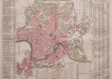
Stunning large map of British Isles with Western and Eastern Hemispheres as insert maps.
The map, published with the Privilidge of the Dutch King, has a Wealth of information on the British Isles as is to to be expected between these competitive global empires .
Under the Western Hemishere is the information of British possessions there and similarly under Eastern Hemisphere the British possessions in Africa and Asia. California still an Island.
Excellent colour in the Arms of British Isles.
Good wash comour
Mint condition for this important map of its day
code : M4644
Cartographer : CHATELAIN Family Henri & Zacharie
Date : 17O8 Amsterdam
Size : 48*63.5 cms
availability : Sold
Price : Sold
Zacharie Chatelain (d.1723) was the father of Henri Abraham (1684-1743) and Zacharie Junior (1690-1754). They worked as a partnership publishing the Atlas Historique, Ou Nouvelle Introduction A L’Histoire … under several different Chatelain imprints, depending on the Chatelain family partnerships at the time of publication. The atlas was published in seven volumes between 1705 and 1720, with a second edition appearing in 1732. The maps were accompanied by information pertaining to cosmography, geography, history, chronology, genealogy, topography, heraldry, and costume of the world.